

"I came expecting a guided tour. I left with a family. The Unlock challenge broke down every wall — by the end of the day, we were swapping numbers."
NORTH VIETNAM · 3D2N
Fansipan 3D2N
$180 / 4.700.000 VND /person
Hanoi → Sa Pa → valley trek Day 1 → Trạm Tôn → 2,800m camp Day 2 → Fansipan summit 3,143m → Sa Pa → Hanoi Day 3.
I'm in →
No payment now · Pay 14 days before · Free cancellation until then
Trip info
Pickup
Old Quarter, Hanoi · 06:30 sleeper bus · Day 1
Group size
3 – 12 people · joined or private group
Transport
Sleeper bus (HN ↔ Sa Pa) · private car · trekking
Meals
Day 1: lunch + dinner · Day 2 & 3: full board
Accommodation
Day 1: Sa Pa guesthouse · Day 2: 2,800m wilderness shelter
Summit
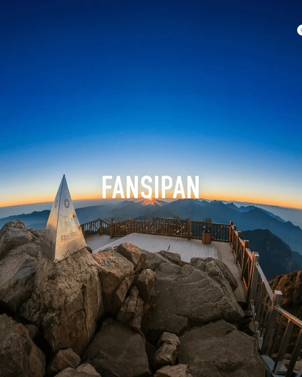
Fansipan 3,143m · Roof of Indochina
Trek
~15km return · 1,700m accumulated gain
Duration
3 days 2 nights · departs Hanoi Day 1
Required
Original passport · checked at ranger checkpoints
The pitch
Fansipan is 3,143m. The cable car takes 20 minutes. The trail takes three days — and those three days are the point.
The summit certificate is the same whether you took the cable car or the trail. What's different is the three days before you got there.
- Day 1 is not a warm-up — it's the valley trek most Fansipan packages skip: Black H'Mông and Giáy villages in the Mường Hoa, rice terraces, a real afternoon on foot before you've even seen the mountain
- The 2,800m camp on the Trạm Tôn ridge is the rarest overnight in North Vietnam — above the cloud layer, below the summit, no infrastructure, no noise
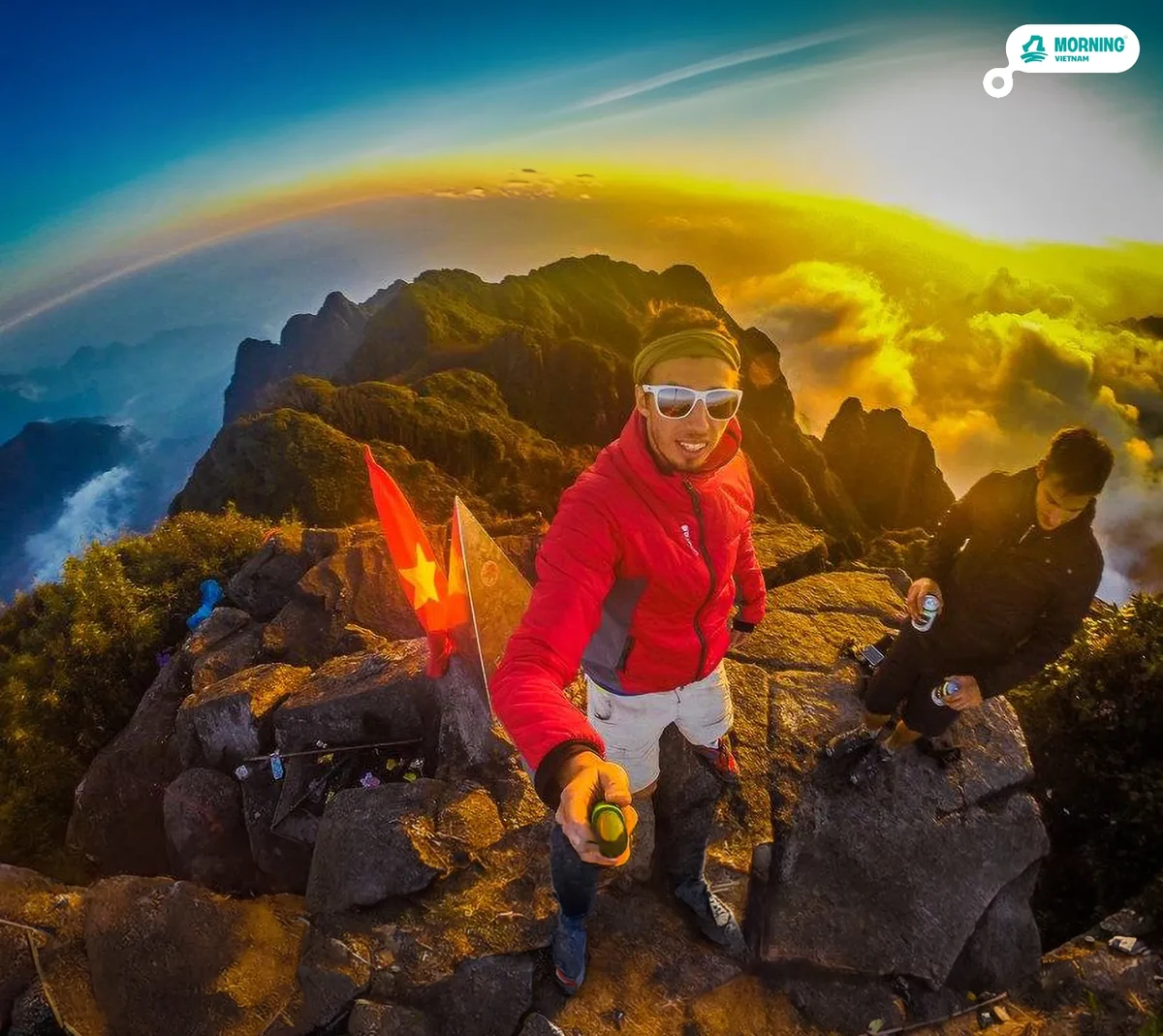
- 4:30am summit push means you arrive at 3,143m as the sun breaks over the Hoàng Liên range — before the cable car runs, before the crowds. The highest point in Vietnam, Laos, and Cambodia — earned on foot
The journey
The journey, mapped.
Time across, elevation up. Every spike is a moment worth remembering.
⏱ Time markers are estimates — actual pace depends on each group's fitness level.
Valley Trek
14:30 – 18:00 · Day 1
Mường Hoa Valley — H'Mông and Giáy Villages
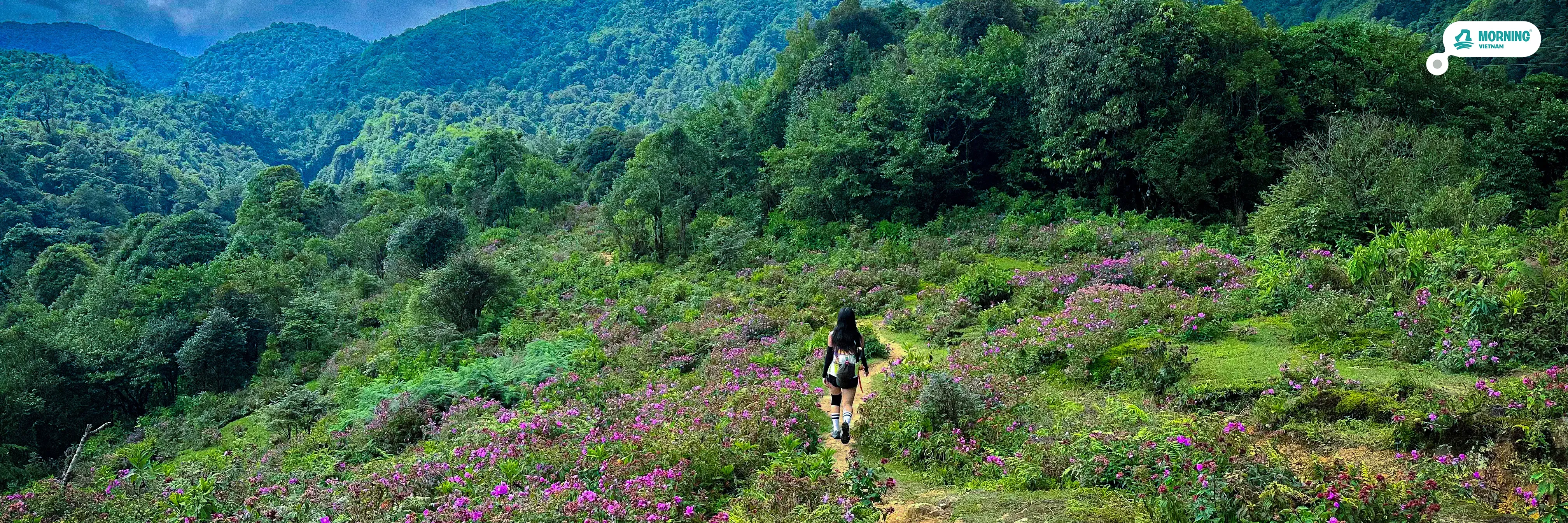
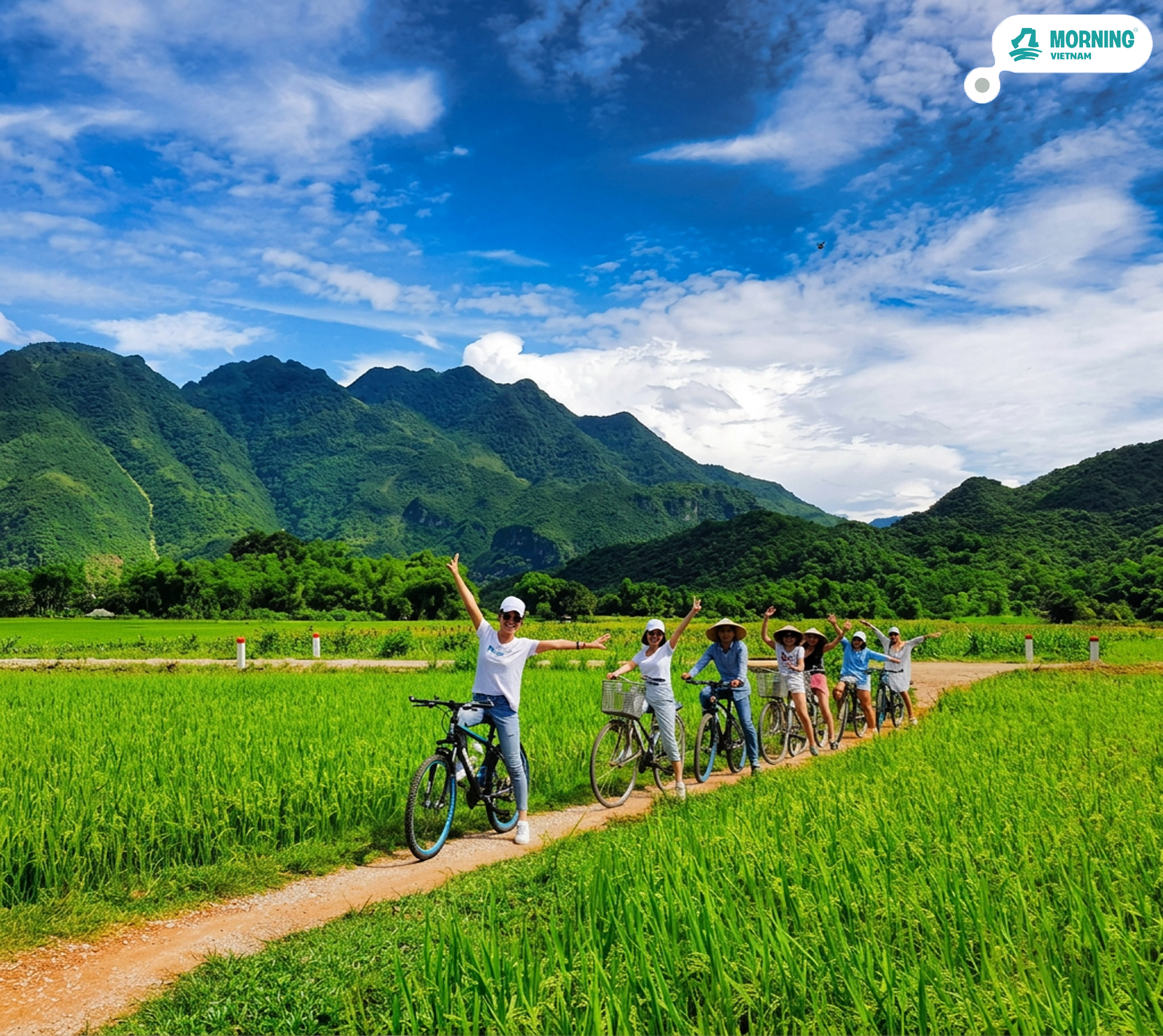
Day 1's afternoon is a 3.5-hour trek through the Mường Hoa valley south of Sa Pa — through Ý Linh Hồ (Black H'Mông), Lao Chải, and on to Tả Van, a Giáy village at the valley floor. The route descends through rice terraces that step in layers down the hillside, passing between fields still farmed by hand. The valley is quieter than Sa Pa town above it, and the light in the late afternoon catches the terraces differently depending on the season. The host introduces you to people and places.
Trek
08:00 – 16:00 · Day 2
Trạm Tôn → Cloud Forest → 2,800m Shelter
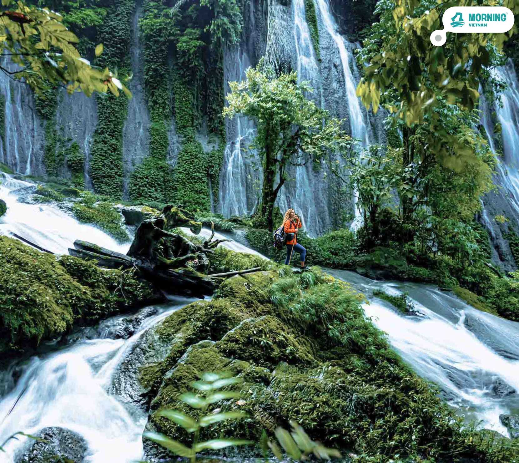
The main climb starts at Trạm Tôn (1,900m) on the northern face of the massif — the same trailhead used by serious trekkers since before the cable car existed. The first section runs through cloud forest: mossy trees, hanging lichen, dense canopy. Above 2,200m the bamboo opens up and the views extend across the Hoàng Liên range. The path steepens as you enter the alpine zone above 2,500m — scrub vegetation, exposed rock, the summit visible above. Total gain is roughly 900m over 6km. The shelter at 2,800m sits on a small flat ridge — tents pitched with a clear view to the west. Time at the shelter: late afternoon to pre-dawn. On a clear night, the cloud layer fills the valley below and you're above it.
Summit
04:45 – 06:30 · Day 3
Fansipan 3,143m — Sunrise at the Roof of Indochina
The final 343m of elevation gain starts before dawn — head torches on, temperature well below Sa Pa, the mountain in silence. The summit of Fansipan sits at 3,143m: the highest point in Vietnam, Laos, and Cambodia combined. The temple complex built after the cable car is there, but at this hour, in these conditions, it reads differently. The sunrise over the Hoàng Liên range happens fast — a hard line of light moving across the ridges below. Summit certificate is included. The cable car doesn't run until 7:30am; most mornings you'll have the top to yourselves before the crowds arrive.
Recovery
11:30 – 12:30 · Day 3
Red Dao Herbal Bath — Sa Pa
The Red Dao herbal bath is a traditional medicinal soak used by Dao communities in the Sa Pa highlands for recovery after physical exertion — a blend of over a dozen mountain plants including bark, roots, and leaves gathered from the forest. The bath runs at roughly 40°C for 45 minutes. After three days of trekking, the effect on the muscles is immediate. Not a spa treatment — a practical recovery method that has existed in these hills for generations. The farewell lunch follows directly after.
More about the destination
The Roof of Indochina — every trekker's dream.
The Hoàng Liên Sơn range is the spine of northern Vietnam — a 180-kilometre ridge running northwest to southeast, marking the boundary between Lào Cai and Lai Châu provinces and forming a hard climatic wall between the Red River basin and the highlands of Lai Châu. Fansipan, at 3,143m, is its highest point and the highest in the old French Indochina territory: higher than anything in Laos or Cambodia. The name is believed to derive from a Hmong phrase meaning 'the huge rocky mountain split in the middle' — a description accurate enough to use as a map. The range is part of Hoàng Liên Sơn National Park, one of Vietnam's most biodiverse protected areas, covering over 29,000 hectares of primary and old-growth forest.
Sa Pa sits at 1,500m on the eastern slope of the range. The French identified it as a hill station site in 1903 and built a resort town here — sanatoriums, villas, a church — exploiting the altitude to escape lowland heat. Most of that architecture is gone. What survived and grew is the town's position as the commercial and social hub for a dozen ethnic minority communities spread across the surrounding valleys: Black H'Mông, Red Dao, Giáy, Tày, Xa Phó. The Mường Hoa valley below Sa Pa to the south contains some of the most extensively cultivated rice terrace landscapes in Southeast Asia — terraces built by H'Mông and Giáy communities over centuries, following the contour lines of slopes that would otherwise be unusable farmland. At the right light and season, the valley floor looks like stacked mirrors.
The vegetation on Fansipan changes completely with every 200m of altitude. Below 2,000m, the north-facing slope is cloud forest: dense, dark, permanent mist, every surface covered in moss, tree ferns growing where they haven't changed since before the road existed. Above 2,000m the forest opens into bamboo — tall, straight, hollow-stemmed, rattling constantly in the wind that comes over the pass. Above 2,500m the bamboo gives way to alpine scrub: dwarf rhododendrons, exposed granite, and a horizon that finally opens. Hoàng Liên Sơn is home to more than 40 rhododendron species — among them ancient trees that bloom between March and April in red, yellow, and deep purple along the upper trail sections and the ridge at 2,800m. Botanists began cataloguing the range's flora seriously only in the 1990s; new species are still being described.
The Red Dao — Người Dao Đỏ — are among the largest ethnic groups in the Sa Pa district and the most visible in the market town. Their red-embroidered headdresses and distinctive tattoo traditions mark them apart even within the already-diverse community of highland peoples here. The Dao are also the keepers of an extensive tradition of medicinal plant knowledge: the herbal bath — tắm thuốc — is not a spa concept but a functional practice, using a specific blend of mountain plants gathered from the forest to treat exhaustion, joint pain, and skin conditions. The formula varies by family but typically includes a dozen or more species, some of which grow only above 1,500m. It is a practice passed down within Dao communities for generations, now available to outsiders through a handful of trusted families in Sa Pa who run the baths the traditional way.

Your welcome pack
Everything in your bag has a reason.
Your host meets you in Sa Pa with a Morning Vietnam pack before the valley trek. One item was chosen for a night spent above the clouds.
Signature format
The Unlock Challenge.
Every Morning Vietnam tour has one. A moment that turns your group from strangers into a team. You won't be told the rules — that's the whole point.
1
Wear the wristband
On the morning of the tour, your guide hands every traveler a Morning Vietnam wristband. It's how the game knows you're playing.
2
A clue enters the day
Somewhere during the trip — your guide won't say when — a card, a signal, or an object enters the picture. From that moment, the game has started.
3
Read it. Move on it. Together.
Your group has to figure out what to do next. No GPS. No guidance from the guide. Just eyes, instinct, and each other. Win or not, you'll remember this part.
Travelling solo or in pairs? The challenge adapts. The valley doesn't care how many of you there are — only that you're paying attention.
When to go
By season.
Fansipan trekking is seasonal. The summit ridge is exposed, and conditions above 2,500m change fast. We monitor forecasts daily and build rain plans for every departure.
Best conditions Good, some haze Wet season — still doable
Best season (Oct – Apr)
Oct–Nov: the most reliable window — post-monsoon clarity, golden rice terraces in the Mường Hoa valley on Day 1, and cloud inversions at camp are most frequent, the valley disappearing below a white layer while you're above it. Mar–Apr: rhododendron season — over 40 species of ancient rhododendron bloom red, yellow, and purple along the route from 2,000m up, making this the most spectacular time for colour on the trail. Jan–Feb: coldest months, below freezing at the summit, snow on the ridge in some years — extraordinary conditions but requires cold-weather gear briefing.
Wet season (May – Sep)
We do not operate this tour May–August. Cloud cover is persistent above 2,000m, the trail gets slippery, and since 2026 national park rangers also close the summit section during severe weather. September can open if a stable weather window appears — we monitor and confirm 48 hours in advance.
Real travelers, real reviews
4.9
Based on 32 reviews
5★29
4★2
3★1
2★0
1★0
"Most tours feel like a museum on wheels. Morning Vietnam feels like a homecoming. The host didn't perform Vietnam — he let us in."
"Eight people, one van, three days. We have a WhatsApp group that's still active a year later. That's it. That's the review."

Your moment.
Your Vietnam.
Tours that don't perform the country to you — they let you in.
See all tours →Ready to go?
Fansipan 3D2N
from $180 / 4.700.000 VND /person
No payment now — reserve your spot, pay 14 days before. Free cancellation.
How fit do I need to be?
High fitness required for Day 2 and Day 3. Day 2 is a full day's trek gaining 900m over 6km on uneven mountain trail — expect 6–8 hours of walking. Day 3 starts at 4:30am and requires another 343m of gain in the dark before the summit. No technical climbing, but this is genuine mountain trekking. Minimum age 16. People who do regular hiking or running will be comfortable. Gym-only fitness is not enough — the altitude affects everyone differently.
What does the camp at 2,800m look like?
Basic tents on a flat ridge — sleeping bags and mats are provided. No running water at camp (we carry what we need), basic camp toilet. The altitude means the temperature drops significantly after sunset — expect 5–10°C at night even in warm seasons, below freezing in winter. The experience is the sky and the silence, not the comfort. If you're expecting a mountain hut, this is different.
What if the summit is clouded over?
Cloud cover is part of mountain trekking in Vietnam — we cannot guarantee clear views. On cloudy summit days, the experience is still the 4:30am walk in the dark, the thinning air, and the ridge at 3,143m. We track conditions and give you an honest forecast 48 hours ahead. The trail and camp experience are unaffected by summit weather.
Can I take the cable car down instead of trekking?
No — the cable car only goes from the Sa Pa valley station to the summit station on the south face. The trek approaches from the north face (Trạm Tôn). You cannot exit via cable car from the trekking route. Descent is the same trail.
What's the difference between this and the Fansipan Only Trekking (2D1N)?
The 2D1N version skips Day 1 entirely — no valley trek, no Sa Pa guesthouse night. You start from Sa Pa in the morning, trek to camp, summit the next day, and return to Sa Pa. It's shorter and cheaper, but you miss the Mường Hoa valley section. If you're already based in Sa Pa or pressed for time, the 2D1N is the right choice.
Do I need a permit?
Yes — since 2026, independent trekking to Fansipan is no longer permitted. A licensed guide and an official permit from Hoàng Liên Sơn National Park are mandatory. Your passport or ID is checked at forest ranger stations on the trail. Going without a permit results in a fine and being turned back. We handle all permits and guide certification as part of the tour — nothing to arrange separately.
What gear do I need to bring?
Ankle-support waterproof hiking boots are essential — the trail is uneven and the camp is exposed and cold. Trekking poles are strongly recommended for the descent: they reduce knee load significantly on the 900m drop from summit to trailhead. Bring a layering system (moisture-wicking base, fleece, waterproof outer), a headlamp for the 4:30am summit push, grip gloves for the rocky sections near the top, and high socks to guard against leeches in the lower forest. Pack weight: aim for 5–7kg in your daypack. Camp gear (sleeping bag, mat, tent) is provided.
Do I need to be fit?
Moderate fitness recommended. Most activities are walking/cycling at a relaxed pace, but some sections may include 30–60 min of uphill.
What's included in the price?
All transport, all meals, accommodation (if multi-day), all activity fees, dedicated host. You only need spending money.
When do I pay?
Reserve your spot first — no payment upfront. Pay 14 days before departure. Free cancellation until then.
Be first to know.
Drop your email/whatsapp number — we'll tell you the day this tour goes live. No spam, no marketing fluff.