

"I came expecting a guided tour. I left with a family. The Unlock challenge broke down every wall — by the end of the day, we were swapping numbers."
NORTH VIETNAM · 2D1N
Fansipan — Only Trekking
$125 / 3.250.000 VND /person
Sa Pa → Trạm Tôn (1,900m) → 2,800m camp Day 1 → Fansipan 3,143m summit at dawn → Sa Pa Day 2.
I'm in →
No payment now · Pay 14 days before · Free cancellation until then · Hanoi pickup +450,000₫/person
Trip info
Pickup
Sa Pa · morning · or Hanoi pickup +450,000₫/person
Group size
3 – 12 people · joined or private group
Transport
Private car Sa Pa ↔ Trạm Tôn · trekking
Meals
Day 1: lunch + dinner · Day 2: full board
Accommodation
2,800m wilderness shelter (tent, sleeping bag, mat)
Summit
Fansipan 3,143m · Roof of Indochina
Trek
~15km return · 1,700m accumulated gain
Duration
2 days 1 night · starts Sa Pa morning
Required
Original passport · checked at ranger checkpoints
The pitch
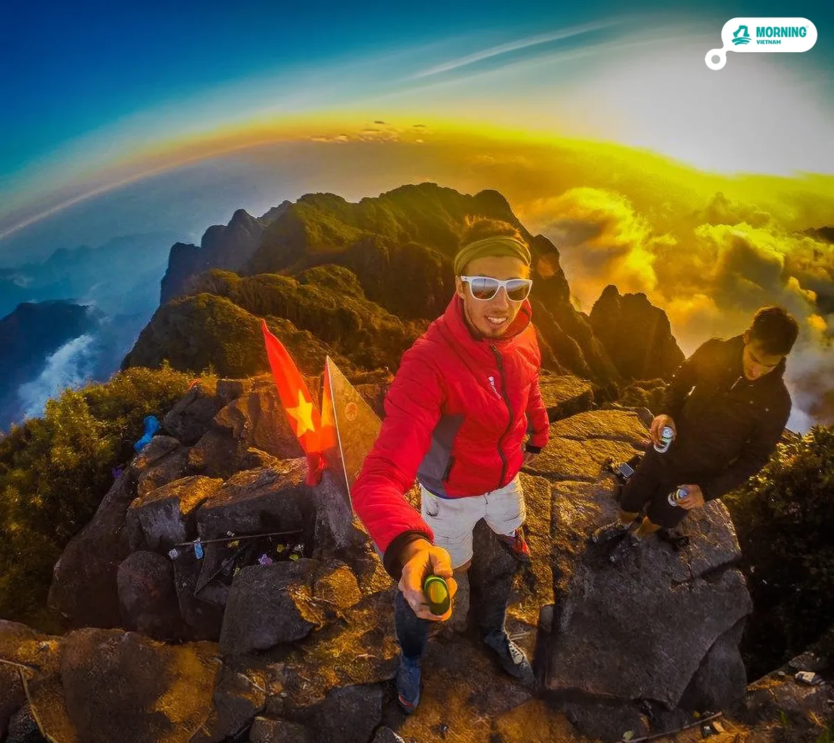
Two days. One night at 2,800m. One sunrise at 3,143m. The direct route — for those already in Sa Pa who want the mountain without anything else.
If you're already in Sa Pa and you have two days, the trail is the only version worth taking.
- Trạm Tôn approach: the original north-face route, starting at 1,900m on Vietnam's highest mountain pass — wide, well-marked, and the most reliable trail to the summit
- 2,800m camp: a ridge above the cloud layer — the rarest overnight in North Vietnam, with spring water, mountain-rated sleeping bags, and the kind of sky you don't see from Sa Pa town
- 4:30am summit push to 3,143m — the highest point in Vietnam, Laos, and Cambodia — at the moment the Hoàng Liên range catches the first light, before the cable car starts running
The journey
The journey, mapped.
Time across, elevation up. Every spike is a moment worth remembering.
⏱ Time markers are estimates — actual pace depends on each group's fitness level.
Trek
09:00 – 17:00 · Day 1
Trạm Tôn → Cloud Forest → 2,800m
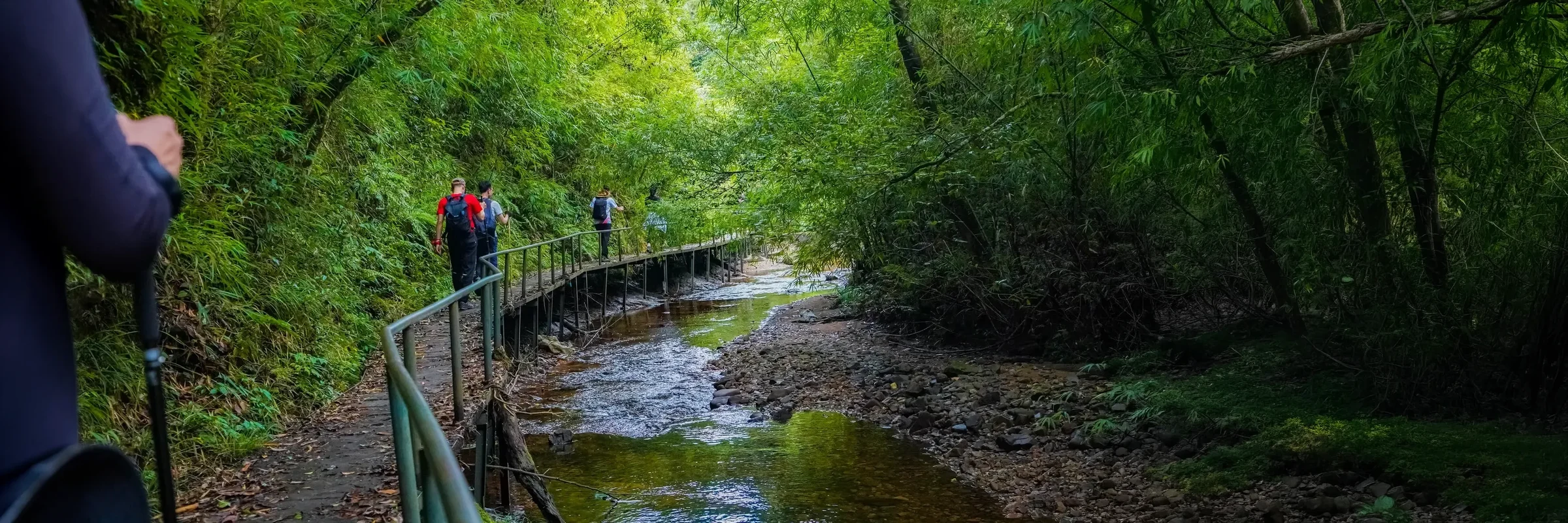
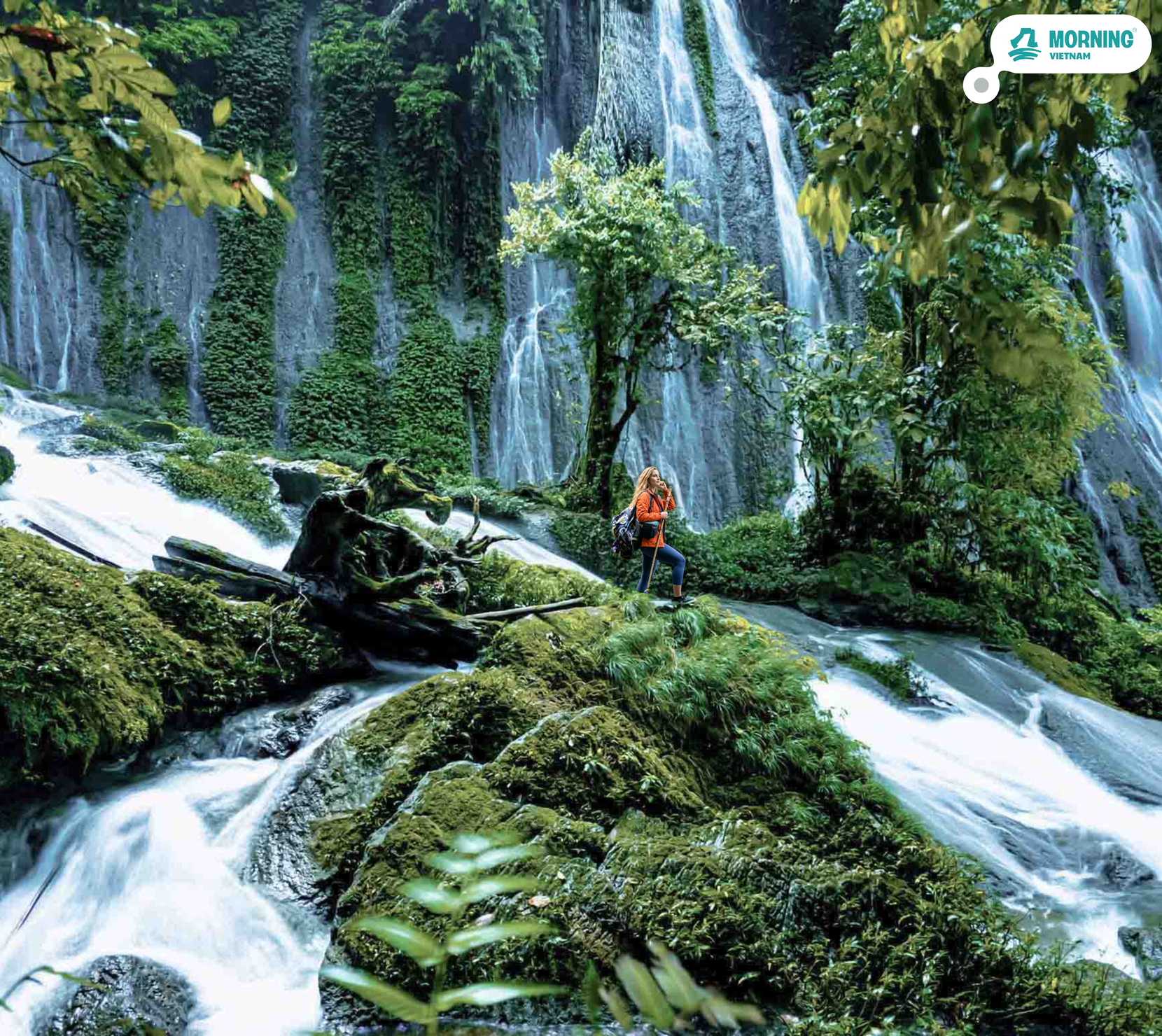
The climb starts at Trạm Tôn trailhead (1,900m) and gains 900m over 6km to the high camp. The route passes through three distinct vegetation zones: dense cloud forest in the lower section, bamboo above 2,000m, and alpine scrub as you approach 2,600m. There are fixed ropes on some steeper sections. Total walking time is 7–8 hours including stops. The trail is uneven, rocky in places, and muddy after rain. Trekking poles are strongly recommended.
Shelter
17:00 – 04:00 · Night
2,800m Wilderness Shelter
The shelter sits on a flat section of ridge at 2,800m — tents, sleeping bags rated for mountain temperatures, and a shelter dinner cooked by your host. On clear nights the valley below is invisible under cloud, and the sky is the widest you've seen. On overcast nights the experience is different: the wind in the tents, the cold, the darkness below the summit. Both are part of this mountain. The alarm goes at 4:00am.
Summit
04:30 – 06:30 · Day 2
Fansipan 3,143m — Roof of Indochina
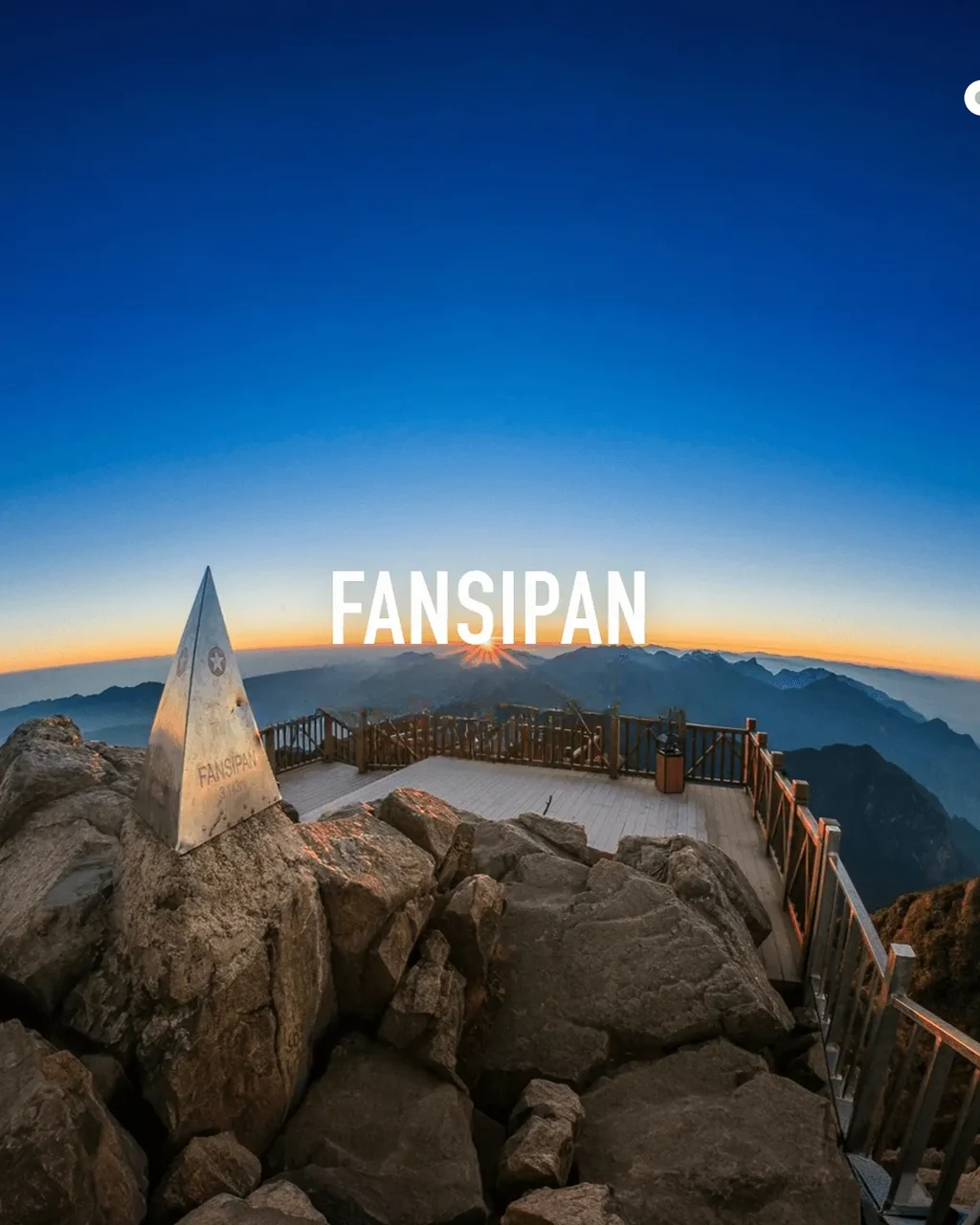
The final 2km from camp to the peak starts in darkness — head torch, cold air, the path steep and familiar by now. The last section includes some scrambling on rocky terrain; your host guides every step. At 3,143m the horizon is a ring of ridgelines. The sunrise moves from east to west across the Hoàng Liên range in about 20 minutes — if the sky is clear. Commemorative medal included. At this hour, before the cable car starts running, the top is yours.
Recovery
15:30 – 17:00 · Day 2
Red Dao Herbal Bath — Sa Pa
After two days on the mountain — 900m of gain, a night at 2,800m, the summit before dawn, and the full descent — the Red Dao herbal bath is not a luxury addition. It's a traditional medicinal practice used by the Red Dao people of the Sa Pa highlands for recovery after physical exertion. The bath is a blend of over a dozen mountain plants: bark, roots, and leaves gathered from the surrounding forest, brewed into a dark aromatic soak at roughly 40°C. The practice improves circulation and accelerates muscle recovery — the Dao communities have used it this way for generations. Forty-five minutes in the water. Every muscle understands the value.
Sa Pa Night
17:00 – 23:00 · Day 2
Sa Pa Evening — Dinner, Square, Night Market
The last hours in Sa Pa. Dinner at a local restaurant in the town centre — the kind of meal after a summit that tastes different from any other. After: the stone church square, the night market, the mix of H'Mông vendors, travellers, and locals that give Sa Pa its after-dark character. The market runs until the streets empty. For those taking the overnight bus, departure is 23:00 and the journey arrives in Hanoi by early morning. For those staying: Sa Pa's hotels are quiet after midnight, and the mountain is still there in the window.
More about the destination
The Roof of Indochina — every trekker's dream.
O Quy Hồ is Vietnam's highest mountain pass — a 50-kilometre road that crosses the Hoàng Liên Sơn range at roughly 1,900m, connecting Sa Pa on the eastern side with the Lai Châu basin to the west. The pass has been a trade and migration route for highland communities for centuries; the modern road was built during the French colonial period and improved repeatedly since. Trạm Tôn, the checkpoint station near the top, is the northern trailhead for Fansipan — the point where the route into the national park begins. The pass itself is one of the most dramatic road sections in Vietnam: cloud-covered most mornings, cleared by wind in the afternoon, with views east across the Sa Pa valley and west toward the Lai Châu lowlands on clear days.
Hoàng Liên Sơn National Park covers 29,845 hectares across the range — established in 1996 and listed as a UNESCO Biosphere Reserve candidate for its exceptional biodiversity. The northern face of Fansipan, where the trekking route runs, is primary forest that has never been logged commercially. The cloud forest below 2,000m supports over 2,000 recorded plant species, among them 20+ orchid species endemic to the range. Above 2,000m, a bamboo belt — Fargesia and Yushania species — forms a near-continuous cover that has historically made navigation above the treeline difficult without a guide. This is part of why independent trekking was restricted: the forest disorients, trails divide, and the weather shifts within minutes at altitude.
The Hoàng Liên Sơn range is geologically part of the same uplift system that produced the Himalayas — formed by the collision of the Indian and Eurasian plates beginning roughly 50 million years ago, continuing to rise at a measurable rate. The rock exposed on Fansipan's upper sections is mainly granite and gneiss, grey and fractured, warm to the touch in the afternoon sun even when the air is cold. The summit area at 3,143m is wind-scoured and exposed: a small plateau of boulders where the Buddhist temple complex was built after the cable car opened in 2016. Below zero temperatures occur at the summit even in April; the daily temperature range from valley floor to peak can exceed 20°C.
Sa Pa town sits at 1,500m and has been the commercial hub for a cluster of highland ethnic communities for over a century — Black H'Mông, Red Dao, Giáy, Tày, Xa Phó. The Saturday market that draws people down from the surrounding villages is one of the oldest in the region, predating the tourist economy. The Red Dao community — known for their red-embroidered headdresses and extensive medicinal plant knowledge — practice tắm thuốc, the herbal bath: a blend of a dozen or more forest plants, boiled and used as a therapeutic soak after physical exertion or illness. The recipe is family-specific and passed down orally. Several Dao families in Sa Pa offer the bath to outsiders using traditional preparations, without the spa-hotel packaging. After two days on the mountain, 40°C water and the specific smell of Dao medicinal plants is something you'll remember longer than the summit.

Your welcome pack
Everything in your bag has a reason.
Your host meets you in Sa Pa with a Morning Vietnam pack before departure to Trạm Tôn. One item was chosen for a night at 2,800m.
Signature format
The Unlock Challenge.
Every Morning Vietnam tour has one. A moment that turns your group from strangers into a team. You won't be told the rules — that's the whole point.
1
Wear the wristband
On the morning of the tour, your guide hands every traveler a Morning Vietnam wristband. It's how the game knows you're playing.
2
A clue enters the day
Somewhere during the trip — your guide won't say when — a card, a signal, or an object enters the picture. From that moment, the game has started.
3
Read it. Move on it. Together.
Your group has to figure out what to do next. No GPS. No guidance from the guide. Just eyes, instinct, and each other. Win or not, you'll remember this part.
Travelling solo or in pairs? The challenge adapts. The valley doesn't care how many of you there are — only that you're paying attention.
When to go
By season.
Fansipan trekking is seasonal. Conditions above 2,500m change fast and the summit ridge is fully exposed. We monitor forecasts 48 hours ahead.
Best conditions Good, some haze Wet season — still doable
Best season (Oct – Apr)
Oct–Nov: clearest skies, post-monsoon air, and cloud inversions most frequent — the valley disappears below a white layer while you're at camp above it. Mar–Apr: rhododendron season — over 40 species of ancient rhododendron bloom red, yellow, and purple along the trail from 2,000m up; the camp ridge has views into the blooming forest below. Jan–Feb: coldest months, below freezing at the summit, ice on the rocky sections near the top — extraordinary conditions, but cold-weather gear briefing required.
Wet season (May – Sep)
We do not operate this tour May–August. Cloud cover is persistent above 2,000m, the trail is slippery, and since 2026 national park rangers close the summit section during severe weather. Leeches are more active in wet season — high socks are always advised regardless. September can open if a stable window appears — we confirm 48 hours ahead.
Real travelers, real reviews
4.9
Based on 32 reviews
5★29
4★2
3★1
2★0
1★0
"Most tours feel like a museum on wheels. Morning Vietnam feels like a homecoming. The host didn't perform Vietnam — he let us in."
"Eight people, one van, three days. We have a WhatsApp group that's still active a year later. That's it. That's the review."
Your moment.
Your Vietnam.
Tours that don't perform the country to you — they let you in.
See all tours →Ready to go?
Fansipan — Only Trekking
from $125 / 3.250.000 VND /person
No payment now — reserve your spot, pay 14 days before. Free cancellation.
How fit do I need to be?
High fitness required. Day 1 is 900m of elevation gain over 6km on mountain trail — 7–8 hours of walking. Day 2 adds another 343m before dawn. No technical climbing, but this is serious trekking. Minimum age 16. Regular hikers will be fine. Gym-only fitness is not enough preparation.
What does the camp look like?
Basic tents on a ridge at 2,800m. Sleeping bags and mats are provided (rated for mountain conditions). No running water at camp. Expect 5–10°C at night in warm months, below freezing in winter. The view is the point, not the comfort.
Can I pick up from Hanoi?
Yes — Hanoi pickup is available at an additional cost of 450,000₫ per person. This means a sleeper bus or private transfer to Sa Pa the night before. We'll arrange the logistics when you enquire.
What if I want to add the valley trekking day?
That's the Fansipan 3D2N tour — it adds a full Day 1 in the Mường Hoa valley (Ý Linh Hồ, Lao Chải, Tả Van) and an extra night in Sa Pa before the mountain section. Same mountain route, but with the cultural context built in.
Can I take the cable car down?
No — the cable car is on the south face and can only be used from the summit station to the valley station on that side. The trekking route is on the north face (Trạm Tôn). Descent is the same trail you climbed.
Do I need a permit?
Yes — since 2026, independent trekking on Fansipan is no longer permitted. A licensed guide and a national park permit from Hoàng Liên Sơn National Park are mandatory. Your passport is checked at forest ranger stations on the trail. We handle all permits and guide certification — nothing to arrange on your side. Trekking without a permit results in a fine and being turned back.
What gear should I bring?
Ankle-support waterproof hiking boots are non-negotiable — the trail is rocky and the camp is exposed. Trekking poles reduce knee load significantly on the 900m descent and are strongly recommended. Bring a layering system (moisture-wicking base, fleece, waterproof outer), a headlamp for the 4:30am push, grip gloves for the rocky sections near the top, and high socks to guard against leeches in the lower forest. Pack weight target: 5–7kg. Sleeping bags, mats, and tents are provided at camp.
Do I need to be fit?
Moderate fitness recommended. Most activities are walking/cycling at a relaxed pace, but some sections may include 30–60 min of uphill.
What's included in the price?
All transport, all meals, accommodation (if multi-day), all activity fees, dedicated host. You only need spending money.
When do I pay?
Reserve your spot first — no payment upfront. Pay 14 days before departure. Free cancellation until then.
Be first to know.
Drop your email/whatsapp number — we'll tell you the day this tour goes live. No spam, no marketing fluff.