

"I came expecting a guided tour. I left with a family. The Unlock challenge broke down every wall — by the end of the day, we were swapping numbers."
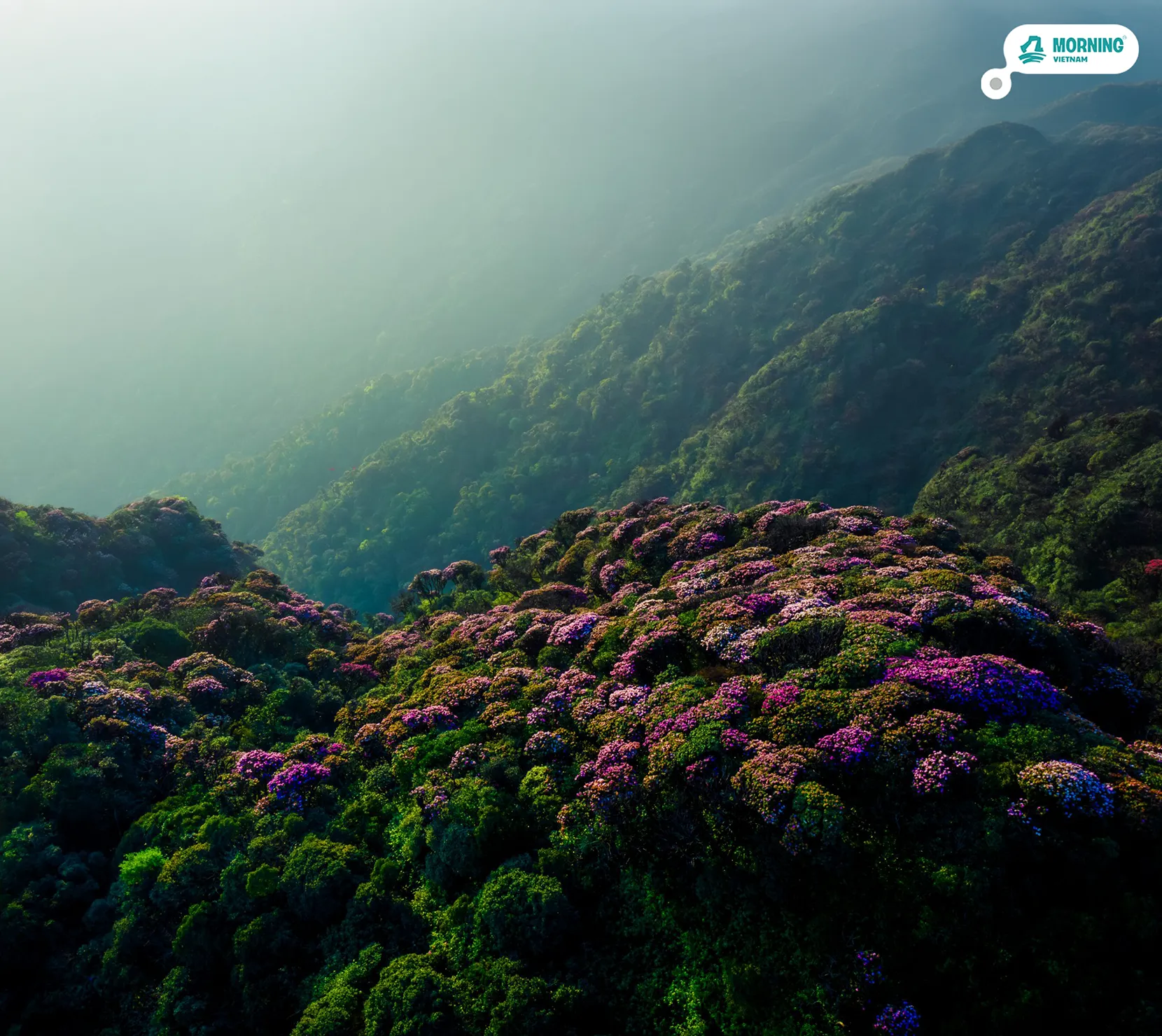
NORTH VIETNAM · 3D2N
Putaleng 3D2N
$163 / 4.250.000 VND /person
Next departures
I'm in →
No payment now · Pay 14 days before · Free cancellation until then
Trip info
Pickup
Mỹ Đình bus station, Hanoi · 07:30 sleeper bus · Day 1
Group size
3 – 12 people · joined or private group
Transport
Sleeper bus (HN → Lai Châu) · minibus · motorbike taxi to trailhead · night bus return
Meals
Day 1: lunch + dinner Day 2 & 3: full board
Accommodation
Day 1: H'Mông homestay (Lao Chải 1) · Day 2: mountain shelter (~2,522m)
Summit
Putaleng 3,049m · 3rd highest in Vietnam
Trek
~23km traverse 1,300m gain (Day 2) ~1,200m net descent (Day 3)
Duration
3 days 2 nights · departs Hanoi Day 1
Required
Original passport or national ID · may be checked at forest checkpoints
The pitch
3,049m — and the summit isn't the point.
The summit is the midpoint. The forest is the point.
- The Tà Lèng approach is a full-elevation traverse — from the valley floor through primary old-growth to the summit, then down through the rhododendron ridge at Rhododendron Peak to a Red Dao village that most visitors to the region never reach
- Day 1 in Lai Châu adds what most Putaleng packages skip: Pusamcap cave and a night in an H'Mông village at the foot of the mountain — context that changes what the forest means when you enter it on Day 2
- Rhododendron density on this massif is exceptional — 30+ species, ancient specimens above 2,200m, and a named ridge (Rhododendron Peak) on the descent that turns the trek into something genuinely different February through April
How tough is it?
4 /5
Hard
Consistently demanding trekking days through primary forest, on a trail with far less infrastructure than Fansipan's. Right for fit, experienced walkers — not a beginner's first mountain.
Physical demand
6–9 hours of trekking on both Day 2 and Day 3, on uneven mountain trail with stream crossings and root-covered ground. ~23km total, 1,300m of ascent and roughly 1,200m of net descent.
Altitude & terrain
Summit at 3,049m is high enough to feel, but the overnight shelter sits at ~2,522m — well below the range where altitude sickness becomes a major risk. No technical climbing; the challenge is distance and terrain, not exposure.
Remoteness
Primary forest with no road access between the Tà Lèng trailhead and Sì Thâu Chải. Phone signal is unreliable above roughly 2,000m. This is genuine backcountry, not a marked park trail.
Route map
Where the trail actually goes.
↻ Drag compass to rotate
Satellite imagery via Esri · actual GPS track recorded on this route
The journey
The journey, mapped.
Time across, elevation up. Every spike is a moment worth remembering.
⏱ Time markers are estimates — actual pace depends on each group's fitness level.
Day 1 H'Mông homestay, Lao Chải 1 Lunch + Dinner
Day 1 — Hanoi → Lai Châu → Lao Chải 1
Day 1 ends in Lai Châu, not at a hotel. Pusamcap cave is a limestone cavern above the Nậm Na river — a short walk from the road, cool and quiet, with the specific silence of karst geology that the granite of the Hoàng Liên range above it doesn't have. Lao Chải 1 is the H'Mông village where the night is spent: stone walls, a homestay dinner cooked over wood, and a view toward the mountain that starts the next morning.
Day 2 Mountain shelter, ~2,522m Full board (B/L/D)
Day 2 — Tà Lèng → Summit Putaleng 3,049m → Shelter
8–9 hrs trekking 10km 1300m up 850m down
The motorbike taxi ride to the trailhead at 1,700m is itself a transition — from the valley road to the forest edge, in 30 minutes of steep mountain track. The trek from there gains 1,300m over roughly 10km to the summit, through primary cloud forest and open bamboo. The summit at 3,049m is reached in the afternoon — the light across the Hoàng Liên range at this hour is different from a dawn push. Descent back to the shelter takes around two hours, for a hot sturgeon-and-beef hotpot — not the plain chicken most trekking shelters serve, even this high up.
Day 3 Night bus Full board (B/L/D)
Day 3 — Shelter → Rhododendron Peak → Sì Thâu Chải → Hanoi
8–9 hrs trekking 13km 200m up 1400m down
The descent follows the Sì Thâu Chải route, not the way up — this is a true traverse. The trail crosses Rhododendron Peak ridge at roughly 2,400m, where more than 30 rhododendron species grow, densest between late February and mid-April. The route ends in Sì Thâu Chải village, a Red Dao community most visitors never reach, where a traditional herbal bath closes out two days in the forest before the night bus back to Hanoi.
More about the destination
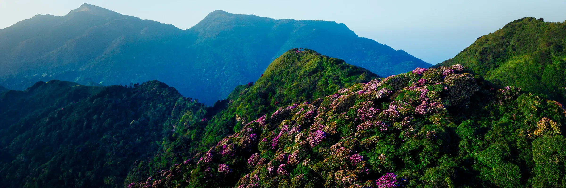
The Kingdom of Rhododendrons — Vietnam's wildest trail.
Putaleng stands at 3,049m in the southern arm of the Hoàng Liên Sơn range, on the Lai Châu side of the massif — 20 kilometres northwest of Fansipan but in a fundamentally different world. Where Fansipan faces northeast toward the Sa Pa valley and the tourist infrastructure that has grown around it, Putaleng faces west toward the Lai Châu basin and the Đà River drainage — a wetter, more isolated exposure that has kept the primary forest intact far longer and far denser than anything on the Sa Pa side. The mountain sits within Tả Lèng commune, Tam Đường district — a name most travellers to the region have never encountered, which is part of what makes it worth knowing. The road from Lai Châu city reaches the village at the valley bottom, and above that, the trail begins on its own terms.
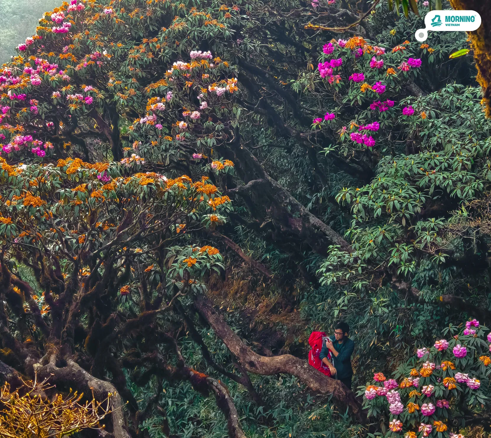
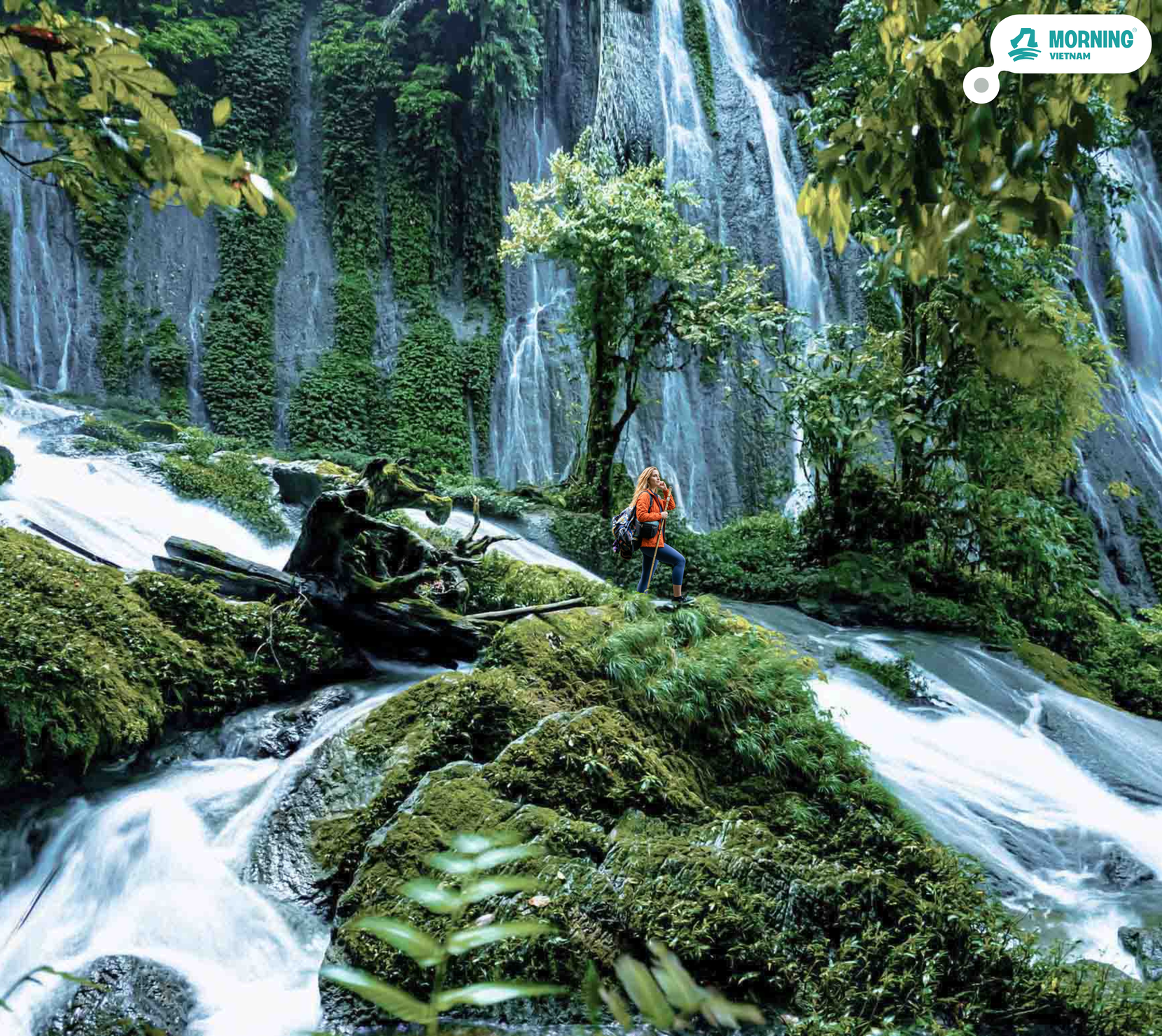
The forest on Putaleng is the main reason climbers who have done both peaks describe the experience differently. Below 2,000m: cloud forest typical of the Hoàng Liên range — dense, dark, every surface covered in moss and lichen, streams cold and constant, the bamboo belt above it so thick it disorients. What Putaleng has that other peaks in the range do not, at least not to the same density, is its rhododendron population. More than 30 species have been recorded within the massif — including ancient specimens several centuries old, with trunks broader than a person's armspan, growing along the ridge between 2,200m and 2,600m. The sub-summit on the descent route — Rhododendron Peak, at approximately 2,400m — has given Putaleng the informal title "kingdom of rhododendrons," earned between late February and mid-April when the blooms cover the ridgeline in red, pink, and white in a display with few parallels in Southeast Asia. The peak was not shaped for visitors; it was named by the people who lived beneath it.
The route from Tả Lèng to Sì Thâu Chải is not simply a traverse — it is a passage between two entirely distinct ethnic worlds. The approach side is H'Mông territory: stone-walled fields, the distinctive roof lines of H'Mông houses, an agricultural economy oriented to the valley floor. The descent side — Sì Thâu Chải village — is a Red Dao (Người Dao Đỏ) community, recognisable by its weaving traditions and the aromatic steam that rises from the houses where herbal baths are prepared. These two communities occupy opposite slopes of the same mountain, speak different languages, and have different material cultures — separated by a summit at 3,049m that both treat as a presence in the landscape rather than a destination. The trek covers both slopes because the trail goes where the people went first.
Safety & remote access
Know before you go.
Medical access time
~6 hours from the furthest point on the route to hospital-level care in Lai Châu — consistent with the benchmark used across Hoàng Liên Sơn treks on this side of the range.
Phone signal
Unreliable above ~2,000m · no signal at the shelter or summit · your guide carries the group's primary means of communication
If something goes wrong
1
On-site response
Your guide carries a first-aid kit and is trained in wilderness first response. Minor injuries, blisters, and early altitude symptoms are treated on the trail and the group's pace is adjusted immediately.
2
Assisted evacuation
If a guest can't continue but isn't in danger, the guide and porters organise a supported descent — using trekking poles, a improvised carry, or the nearest point a motorbike can reach — to the closest village or ranger checkpoint.
3
Medical evacuation
For serious cases, the guide contacts local emergency support and coordinates transport to the nearest hospital-level facility (Lai Châu or Sa Pa). Travel insurance covering emergency evacuation is required for every booking.
Travel insurance is included for every guest, with coverage up to 100,000,000₫ per person per incident — including emergency evacuation costs.

Before you go
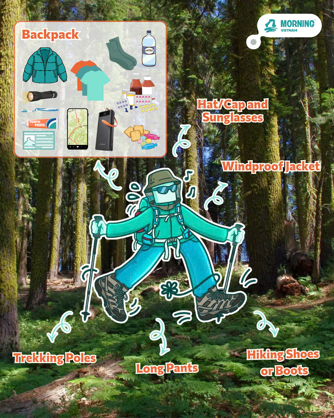
What to pack.
Clothing
- Quick-dry hiking clothes (avoid cotton)
- Warm mid-layer for shelter nights
- Waterproof rain jacket
- High socks — leech protection in lower forest
Footwear
- Broken-in waterproof hiking boots with ankle support
- Camp sandals for the shelter
Health & comfort
- Personal medication
- Blister plasters
- Insect repellent
- Sunscreen and a hat
- Hand sanitiser
Shelter nights
- Sleeping bag liner if you run cold (blankets provided)
- Headlamp with spare batteries
Documents & extras
- Original passport or national ID
- Portable power bank
- Cash for tips (not included in tour price)

Your welcome pack
Everything in your bag has a reason.
Your host meets you at Mỹ Đình or in Lai Châu with a Morning Vietnam pack before the trek. One item was chosen for a night at altitude in a mountain shelter.
Upcoming Departures
Next dates you can join.
Spots fill fast — reserve now, pay 14 days before. Free cancellation up to 7 days out.
Reserve a spot → Fri 9 Oct Reserve spot →
When to go
By season.
Putaleng is a year-round mountain for experienced trekkers — but the experience is dramatically different depending on the season. The rhododendron bloom is the defining seasonal event, and the post-monsoon window offers the clearest conditions.
Best conditions Good, some haze Wet season — still doable
Rhododendron season (Feb – Apr)
The Putaleng massif hosts over 30 rhododendron species — and the bloom on the Rhododendron Peak ridge and the upper trail is the reason experienced trekkers time their visit. Peak colour is mid-March to mid-April: the ridge between 2,200m and 2,600m turns red, pink, and white under continuous canopy of blooms on trees several centuries old. February marks the beginning — earlier than Fansipan, because the Lai Châu side of the range is warmer and wetter. This is the most visually striking window in the Vietnamese trekking calendar.
Post-monsoon best (Oct – Nov)
Oct–Nov is the clearest weather window: post-monsoon skies, strong light, the summit views extending across the Hoàng Liên range. The forest is at its greenest from the wet season rainfall, the streams are full, and the temperature at shelter altitude (~2,522m) is cold enough at night to make the sleeping bags earn their rating — roughly 8–12°C — without the below-freezing conditions of winter.
Wet season (May – Sep)
We operate this route May–August only for experienced groups who understand the conditions: persistent cloud above 2,000m, slippery trail, leeches active in the lower forest (high socks essential). The primary forest in wet season has its own character — the moss is saturated, the streams are loud, the light inside the canopy is extraordinary — but the summit views are rarely clear. September often transitions to stable weather; we monitor and confirm 48 hours ahead.
Winter (Jan, Dec)
Cold and dry. Below freezing at the shelter and summit in some years. The forest is still, visibility excellent on clear days, and the trail is at its quietest. Cold-weather sleeping bags and layering are required. Snow is rare but has occurred on the upper ridge — a memorable experience if conditions align.
Real travelers, real reviews
4.9
Based on 32 reviews
5★29
4★2
3★1
2★0
1★0
"Most tours feel like a museum on wheels. Morning Vietnam feels like a homecoming. The host didn't perform Vietnam — he let us in."
"Eight people, one van, three days. We have a WhatsApp group that's still active a year later. That's it. That's the review."

Your moment.
Your Vietnam.
Tours that don't perform the country to you — they let you in.
See all tours →Ready to go?
Putaleng 3D2N
from $163 / 4.250.000 VND /person
No payment now — reserve your spot, pay 14 days before. Free cancellation.
How fit do I need to be?
High fitness required for Day 2. The main climb gains 1,300m over approximately 10km from the trailhead — expect 6–7 hours of ascent on uneven mountain trail, much of it in dense forest with roots and stream crossings. The descent on Day 3 is 900m over 13km with a partial re-ascent to Rhododendron Peak. No technical climbing, but this is serious mountain trekking. Minimum age 16. Regular hikers and runners will manage. Gym-only fitness is not adequate preparation.
What is the shelter like?
A basic wooden mountain shelter at approximately 2,522m — sleeping on mats or wooden bunks, blankets provided. There are basic toilet facilities. The shelter is not heated — temperature at this altitude drops to 8–15°C at night in warm seasons, below freezing in winter. Bring a layering system and expect cold. The shelter is shared between your group and the porter team.
What makes Putaleng different from Fansipan?
Different mountain, different approach, completely different forest. Fansipan has more infrastructure and a well-established tourist route; Putaleng's Tà Lèng approach is primary old-growth that has seen far fewer visitors. Putaleng also involves a true traverse — you start in one valley and finish in another, crossing two ethnic communities (H'Mông and Red Dao) in the process. The rhododendron forest on the descent route is exceptional and has no equivalent on the Fansipan trail.
Is the rhododendron bloom guaranteed?
No — bloom timing varies by year and altitude. The Rhododendron Peak ridge typically blooms between late February and mid-April, with peak colour in mid-March. Earlier and later in that window the blooms are partial. We give honest forecasts based on conditions that year. Outside bloom season the forest is still remarkable — ancient specimens, dense rhododendron coverage, extraordinary moss and lichen. The forest earns the name even when nothing is flowering.
Do I need a permit?
A local forest permit is required and is included in the tour fee. The Putaleng route does not require the same national park permitting as Fansipan, but the forest is managed and trekking without a registered guide and permit is not permitted. Your guide handles all paperwork.
What gear do I need to bring?
Ankle-support waterproof hiking boots are essential — the Tà Lèng trail has frequent stream crossings and the lower forest is wet. Trekking poles are strongly recommended for the 900m descent on Day 3. Bring a layering system (moisture-wicking base, fleece, waterproof outer), high socks against leeches in the lower forest, and a headlamp. Pack weight: aim for 5–7kg in your daypack — the porter carries your overnight gear. Blankets are provided at the shelter but bring a light sleeping bag liner if you run cold.
Is Putaleng harder than Fansipan?
Yes — on our difficulty scale, Fansipan sits at 'Advanced' and Putaleng at 'Hard,' a real step up. It's not really about elevation (Fansipan is actually 94m taller); it comes down to infrastructure and remoteness. Fansipan's Trạm Tôn route is Vietnam's most established high-mountain trailhead, with rangers, a maintained trail, and the cable car nearby. The Tà Lèng trailhead has none of that — you're in primary forest from the first step, and phone signal is unreliable above 2,000m. The descent traverse via Rhododendron Peak and Sì Thâu Chải also adds distance compared to Fansipan's out-and-back, making Day 3 the longest day of either trek. Both are achievable for fit, experienced walkers — Fansipan suits a first big mountain, Putaleng rewards those who've already done at least one serious multi-day trek.
What's the guide-to-guest ratio?
A lead guide travels with every group, and porter support scales up with group size — roughly one extra porter for every 2–4 additional guests, up to 3 dedicated porters on our largest groups (12 people).
What's dinner like on the mountain?
Sturgeon and beef hotpot at the shelter on Day 2 — not the plain chicken hotpot most trekking tours serve, even this high up. It's a genuine reward after the summit push, and easier eating for international guests unfamiliar with Vietnamese-style whole-bird cuts. Day 3's closing dinner in Sì Thâu Chải is chicken and beef hotpot, alongside the Red Dao herbal bath.
Do I need to be fit?
Moderate fitness recommended. Most activities are walking/cycling at a relaxed pace, but some sections may include 30–60 min of uphill.
What's included in the price?
All transport, all meals, accommodation (if multi-day), all activity fees, dedicated host. You only need spending money.
When do I pay?
Reserve your spot first — no payment upfront. Pay 14 days before departure. Free cancellation until then.
Be first to know.
Drop your email/whatsapp number — we'll tell you the day this tour goes live. No spam, no marketing fluff.