Northern Vietnam has half a dozen motorbike loops worth riding, not one. Ha Giang is the famous one — the most dramatic and the most developed, and also the most crowded. Cao Bằng, Ba Bể, Mai Châu and Y Tý are quieter in different ways. And the northwest, around Lai Châu and Điện Biên, stays almost empty. Here is how they actually differ, and how to pick.
The main motorbike loops in northern Vietnam
Distances and days vary with pace and detours — these are the lengths people usually ride, not fixed routes.
| Loop | Where | Usually ridden in | What it’s like | Crowds |
|---|---|---|---|---|
| Ha Giang Loop | Hà Giang, far north | 3–4 days (~350 km) | Limestone plateau, Mã Pí Lèng pass, Nho Quế river | Busiest by a long way |
| Cao Bằng | Northeast | 2–4 days | Karst valleys, Bản Giốc waterfall on the border | Moderate |
| Ba Bể | Bắc Kạn | Usually combined with another route | Lake, stilt-house homestays, gentle riding | Quiet |
| Mai Châu – Pù Luông | Hòa Bình / Thanh Hóa | 3–5 days | One pass in, then flat valley floor | Moderate, easiest for beginners |
| Y Tý / Mù Cang Chải | Lào Cai / Yên Bái | ~4 days | Rice terraces, cloud season, rougher surfaces | Quiet |
| Lai Châu Loop | Lai Châu / Điện Biên | 3 days (~400 km) | Stone plateau, reservoir, boat crossing, 3 cultures | Emptiest of these |
Ha Giang Loop: what you’re actually signing up for
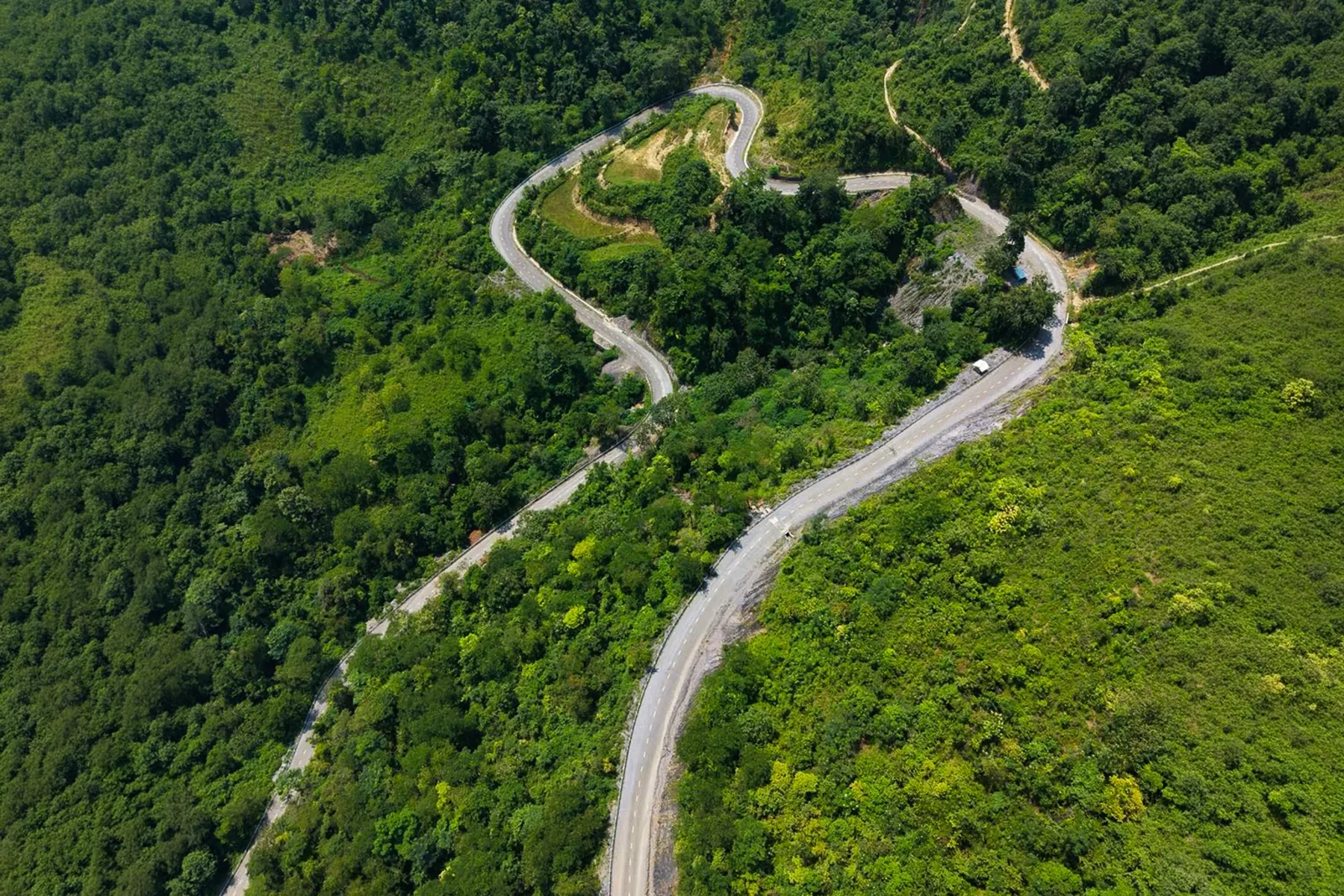
I’ve ridden Ha Giang, and it deserves its reputation. The loop is a circuit of roughly 350 km from Ha Giang City through Quản Bạ, Yên Minh, Đồng Văn and Mèo Vạc, following the road known as the “Happiness Road” across the Đồng Văn Karst Plateau — a UNESCO Global Geopark. Mã Pí Lèng pass and the views down to the Nho Quế river are among the most dramatic things you can see from a road in Vietnam.
Now the honest part. Hà Giang province targeted around 3.5 million visitors in 2025, and the loop corridor is where most of them go. In practice that means three things:
You ride it in company. At peak times the road moves in convoys, and the viewpoints have queues. The silence most people imagine when they picture the far north isn’t really there any more.
Services are stretched. Vietnamese press has reported repeatedly on infrastructure and staffing struggling to keep up with the arrival numbers — accommodation quality varies a lot, and guiding standards vary with it.
Safety is uneven. A large share of riders on the loop are renting a motorbike for the first time, on steep passes with tight curves and long descents. That mix is the reason the route shows up in accident reporting.
None of this means don’t go. It means go knowing what it is: the most spectacular road in the north, shared with a lot of other people. If what you want is empty road, keep reading.
The quieter loops
Cao Bằng is the most common answer to “where else?” — karst valleys, cave systems and Bản Giốc waterfall on the Chinese border, usually ridden over two to four days. Busier every year, but nothing like Ha Giang.
Ba Bể is less a loop than a section: a lake, stilt-house homestays and easy riding, normally tacked onto a northeast route rather than ridden alone.
Mai Châu – Pù Luông is the beginner’s route, and the one I’d send a first-time mountain rider to. One pass to get in, then a flat valley floor between limestone walls. Three to five days depending how far you push into Pù Luông.
Y Tý and Mù Cang Chải give you the rice terraces and, in the cold months, the sea of clouds — about four days. I’ve ridden this one too: surfaces are rougher and sections are genuinely remote, so it suits riders who already know what they’re doing.
The Lai Châu Loop
This is the one we run, and it’s the reason this article exists: almost nobody writes about the northwest in English.
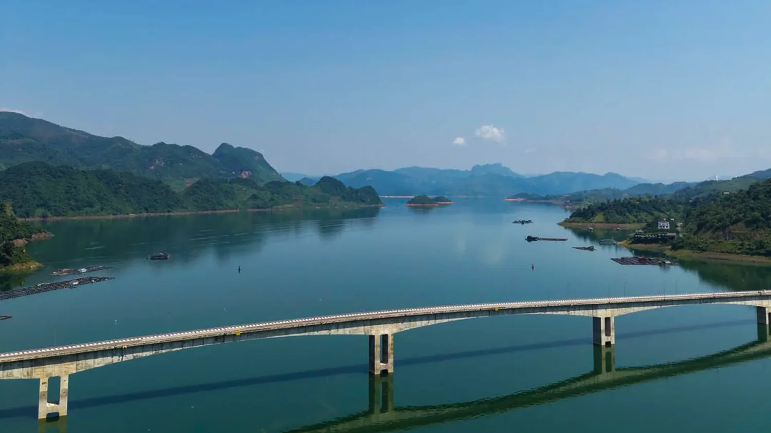
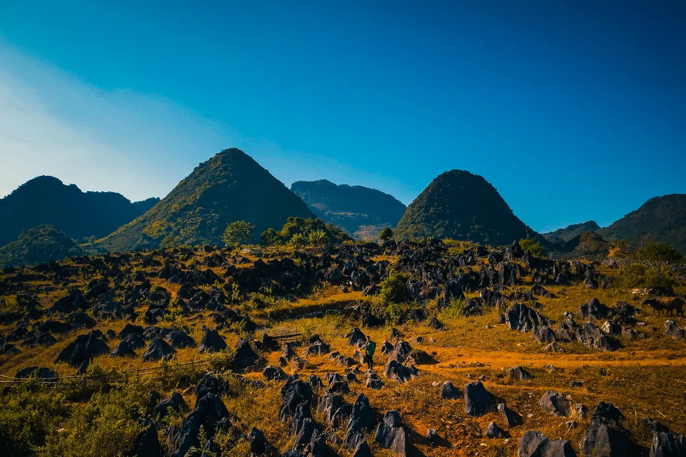
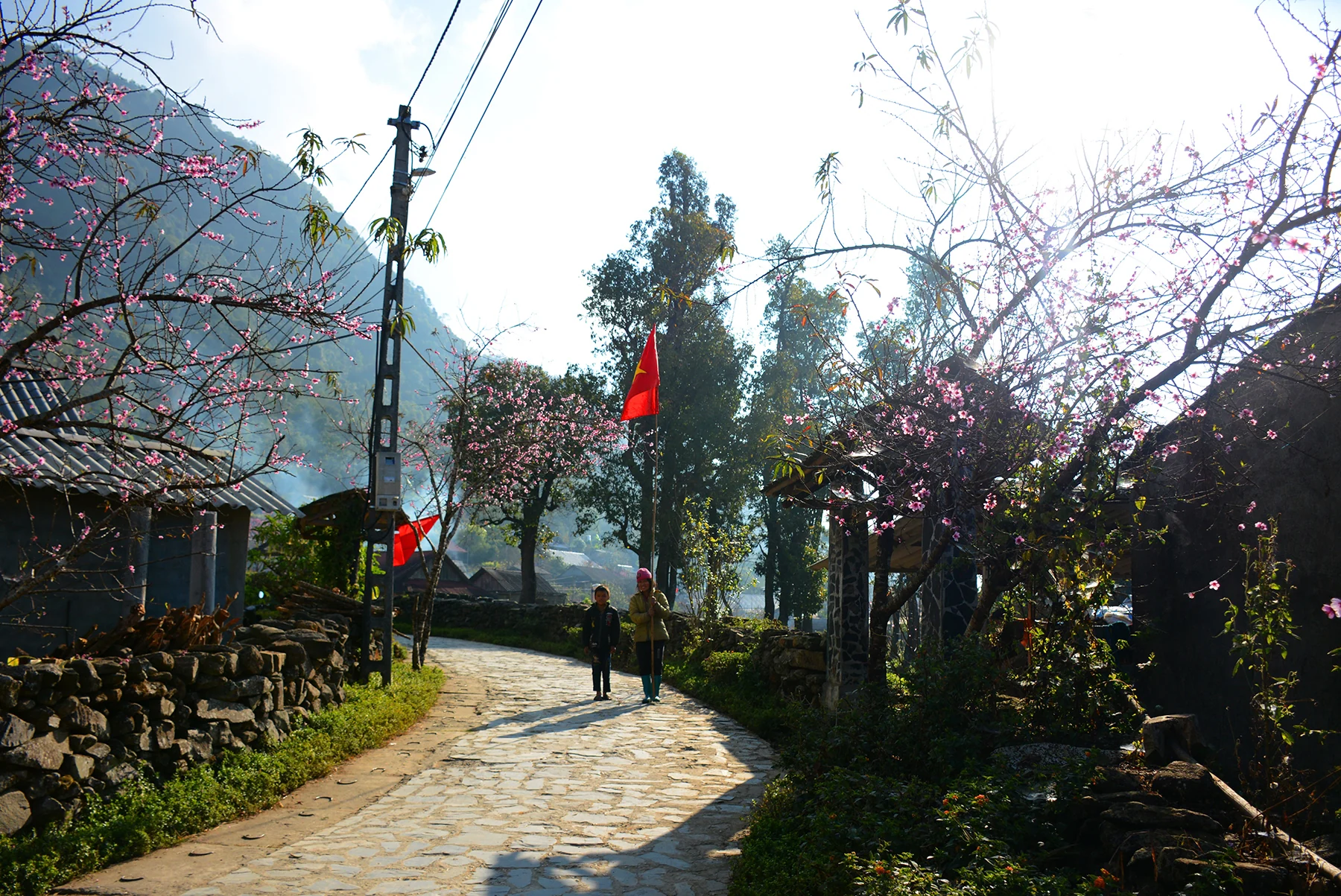
The Lai Châu Loop covers about 400 km over three riding days — roughly 150 km, 140 km and 111 km. From Tam Đường it climbs to Sìn Hồ, drops to Mường Lay — a town whose old valley now lies under the Da River reservoir, so you arrive along bridges above a lake — then crosses the Tủa Chùa stone plateau, a bare limestone landscape most travellers associate only with Đồng Văn. You sleep in a Thai family homestay and at a suspension bridge over the lake at Pa Phông, and finish at Sì Thâu Chải, a Red Dao village at 1,450 m above the Lai Châu valley.
Three things genuinely separate it from the loops above.
The boat crossing is not optional — and that’s the point. On the third morning the route reaches a stretch of the Da River reservoir with no road at all. The only way forward is a boat that takes about five motorbikes and twenty people at a time. You ride on, cross the drowned valley with the bikes beside you, and ride off the other side. No other northern loop does this, and it’s the thing riders talk about afterwards.
Three cultures along one road. Thai at Mường Lay, H’Mông on the Tủa Chùa plateau, Red Dao at Sì Thâu Chải — not scheduled “village visits”, simply who lives along the route.
Almost no other travellers. You’ll pass local traffic, not convoys. That is the whole trade: you give up Mã Pí Lèng, and you get the road to yourself.
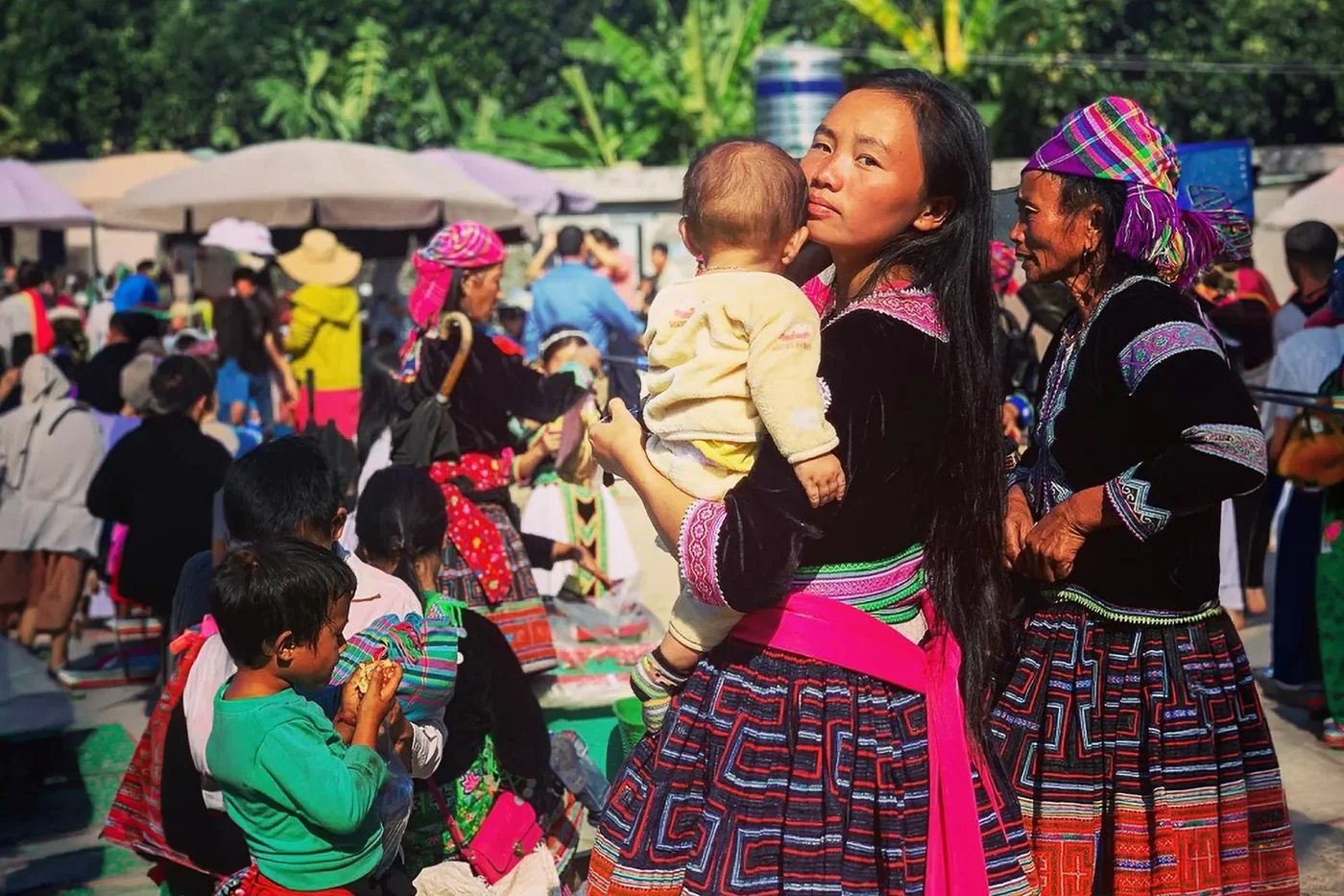
Two waterfalls break up the riding — Thác Bay in the Sìn Hồ forest and Thác Tác Tình near Tam Đường. And if your dates fall right, the loop opens at the San Thàng market, a rotating highland market about 5 km outside Lai Châu city that runs on Thursdays and Sundays — Thai, H’Mông and Dao traders, and food stalls going from first light.
Self-ride or easy-rider? The licence question
This is the part most loop pages skip, so here it is plainly.
To ride a motorbike legally in Vietnam you need a valid Vietnamese licence endorsed for that vehicle class. The U.S. Department of State advises that International Driving Permits and U.S. driver’s licences are not valid in Vietnam, and that foreigners who rent vehicles risk penalties for driving without one. Riding without a valid licence can also void your travel insurance — which matters far more than a fine if something goes wrong on a mountain pass.
Check your own government’s current guidance and your insurer’s wording before you plan to self-ride. If that rules it out, the easy-rider option — a local driver rides, you travel as a passenger — gets you the same roads without the problem.
The bike, if you do ride. We run the Yamaha PG1: a light trail-styled bike of about 115cc, four-speed, with an automatic clutch — you change gear with your foot and there’s no clutch lever to manage. It’s one of the easier bikes to learn on, and its ground clearance suits the rougher sections better than a scooter. That said, three mountain days is still three mountain days: some riding experience helps, and if you’ve never ridden a geared bike, say so when you book.

When to ride
The good windows are roughly late September to November and March to April. Avoid the heaviest rain from about May to August.
On a loop the risk is different from a trek: the danger isn’t being rained on, it’s a landslide closing a mountain road while you’re on the far side of it. Rain that fell days ago in a valley you’ll ride through tomorrow matters more than the forecast where you’re standing. We wrote up how to read that in our guide to the best time to trek northern Vietnam and reading the rainy season — the rainfall thresholds in it apply just as well to roads.
How to choose
- You want the most famous scenery and don’t mind crowds → Ha Giang.
- You’ve never ridden mountain roads → Mai Châu – Pù Luông.
- You want a lake and a slow night → Ba Bể, added to a northeast route.
- You want waterfalls and karst without Ha Giang’s traffic → Cao Bằng.
- You’re a confident rider chasing rice terraces or cloud → Y Tý or Mù Cang Chải.
- You want empty roads, three cultures and a river crossing → the Lai Châu Loop.
If you’d rather walk than ride, the same region has the country’s highest peaks — see our guide to trekking Vietnam’s highest peaks, or read a guest essay from Putaleng’s rhododendron forest in the same province.
FAQ
Which motorbike loop in northern Vietnam is best? It depends what you want. Ha Giang has the most dramatic scenery and the most developed services, but it is by far the busiest. Mai Châu–Pù Luông is the gentlest for new riders. Cao Bằng and Ba Bể are quieter northeastern options. Y Tý and Mù Cang Chải suit confident riders chasing rice terraces and cloud. The Lai Châu Loop in the northwest is the quietest, and the only one with a boat crossing on the Da River.
How long is the Ha Giang Loop? The Ha Giang Loop is commonly described as a circuit of about 350 km starting and ending in Ha Giang City, running through Quản Bạ, Yên Minh, Đồng Văn and Mèo Vạc on the Đồng Văn Karst Plateau, a UNESCO Global Geopark. Most riders take three to four days.
Is there a quieter alternative to the Ha Giang Loop? Yes. The northwest — Lai Châu and Điện Biên — sees a fraction of the traffic. The Lai Châu Loop covers about 400 km over three riding days, from Sìn Hồ through Mường Lay and the Tủa Chùa stone plateau, including a boat crossing on the Da River reservoir and a night in a Red Dao village at 1,450m. Cao Bằng and Ba Bể in the northeast are the other common quieter choices.
Can tourists legally ride a motorbike in Vietnam? You need a valid Vietnamese licence endorsed for the vehicle class. The U.S. Department of State advises that International Driving Permits and U.S. driver’s licences are not valid in Vietnam, and that foreigners renting vehicles risk penalties for riding without a Vietnamese licence. Riding without one can also void travel insurance. Check your own government’s current advice before you plan to self-ride.
What bike do you ride on the Lai Châu Loop, and is it hard? A Yamaha PG1 — a light trail-styled bike of about 115cc with a four-speed gearbox and an automatic clutch, so you change gear with your foot and there is no clutch lever to manage. It is one of the easier bikes to learn on, but the loop still involves long mountain days, so some riding experience helps. If you would rather not ride, the easy-rider option puts you on the back with a local driver.
When is the best time to ride a loop in northern Vietnam? Roughly late September to November and March to April. Avoid the heaviest rains from about May to August, when landslides close mountain roads — on a loop the main risk is the road itself, not the weather where you are standing.
Written by Thế Anh, co-founder of Morning Vietnam. I’ve ridden Ha Giang, Mai Châu and Y Tý myself; the Cao Bằng and Ba Bể notes come from research and from riders we trust. Licence and insurance rules change — always check current official guidance for your nationality before you ride.