Vietnam’s highest mountains — all fifteen of them above 2,800m — sit in the northwest, within reach of Sa Pa, Lai Châu and Yên Bái. Most are two-to-four-day guided treks, not technical climbs. Beginners usually start with Lảo Thẩn or Tà Xùa and work their way up to Fansipan, Putaleng and Ky Quan San. Here is how to choose your first peak, get there, and organize the trip — written from years of climbing these mountains before Morning Vietnam existed.
1. How trekking Vietnam’s peaks has changed
Not long ago, Vietnam had “fifteen highest peaks” and not much else. You would go off to blaze a trail, drag yourself up, take a few photos at the summit — often socked in by cloud — and head back down. Only a handful of people were out there.
Fast forward to today and there are fifteen-plus peaks on everyone’s list. Most trails are well worn now, with photo spots from the foot of the mountain to the summit. Tour operators have popped up everywhere, the trails are busy, and the mountain shelters are often full. Go on a weekend and you rarely get the quiet we used to have. The upside: it has never been easier or safer to start. The downside: picking the right peak, the right season and the right way to go matters more than ever if you want a good experience.
2. Which peak should you climb first?
Peaks are ranked both by height and by difficulty, and the two don’t always line up — a well-developed trail can make a tall mountain easier than a shorter, rougher one. Here is how the main northwest peaks break down by difficulty:
| Level | Peaks |
|---|---|
| Basic (easy) | Lảo Thẩn, Tà Xùa |
| Advanced (moderate) | Fansipan, Lùng Cúng, Tà Chì Nhù, Tả Liên Sơn |
| Challenging (hard) | Ngũ Chỉ Sơn, Nhìu Cồ San |
| Hard | Ky Quan San (Bạch Mộc Lương Tử), Khang Su Văn, Putaleng |
| Extremely hard | Pusilung, Nam Kang Ho Tao, Pờ Ma Lung – Chung Nhía Vũ (combo) |
Notice that Fansipan — the highest at 3,143m — sits in “Advanced,” not the hardest tier. That is because the Trạm Tôn route up the north face is the most developed trail in the country. Height and difficulty are different things.
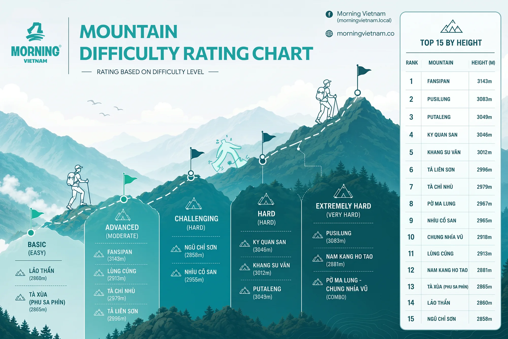
Most people follow the same path: start with an easy overnight like Lảo Thẩn or Tà Xùa, then step up through the advanced peaks, and eventually take on Putaleng or Ky Quan San once you know how your body handles two or three days on the mountain. Leave the extremely hard peaks — Pusilung, Nam Kang Ho Tao — until you have real multi-day stamina.
Vietnam’s 15 highest peaks, by height
Every one of them is in the northwest, and all fifteen clear 2,800m.
| # | Mountain | Height | Difficulty |
|---|---|---|---|
| 1 | Fansipan | 3,143 m | Advanced |
| 2 | Pusilung | 3,083 m | Extremely hard |
| 3 | Putaleng | 3,049 m | Hard |
| 4 | Ky Quan San (Bạch Mộc Lương Tử) | 3,046 m | Hard |
| 5 | Khang Su Văn | 3,012 m | Hard |
| 6 | Tả Liên Sơn | 2,996 m | Advanced |
| 7 | Tà Chì Nhù | 2,979 m | Advanced |
| 8 | Pờ Ma Lung | 2,967 m | Extremely hard (combo) |
| 9 | Nhìu Cồ San | 2,965 m | Challenging |
| 10 | Chung Nhía Vũ | 2,918 m | Extremely hard (combo) |
| 11 | Lùng Cúng | 2,913 m | Advanced |
| 12 | Nam Kang Ho Tao | 2,881 m | Extremely hard |
| 13 | Tà Xùa (Phu Sa Phìn) | 2,865 m | Basic |
| 14 | Lảo Thẩn | 2,860 m | Basic |
| 15 | Ngũ Chỉ Sơn | 2,858 m | Challenging |
Fansipan (3,143m)
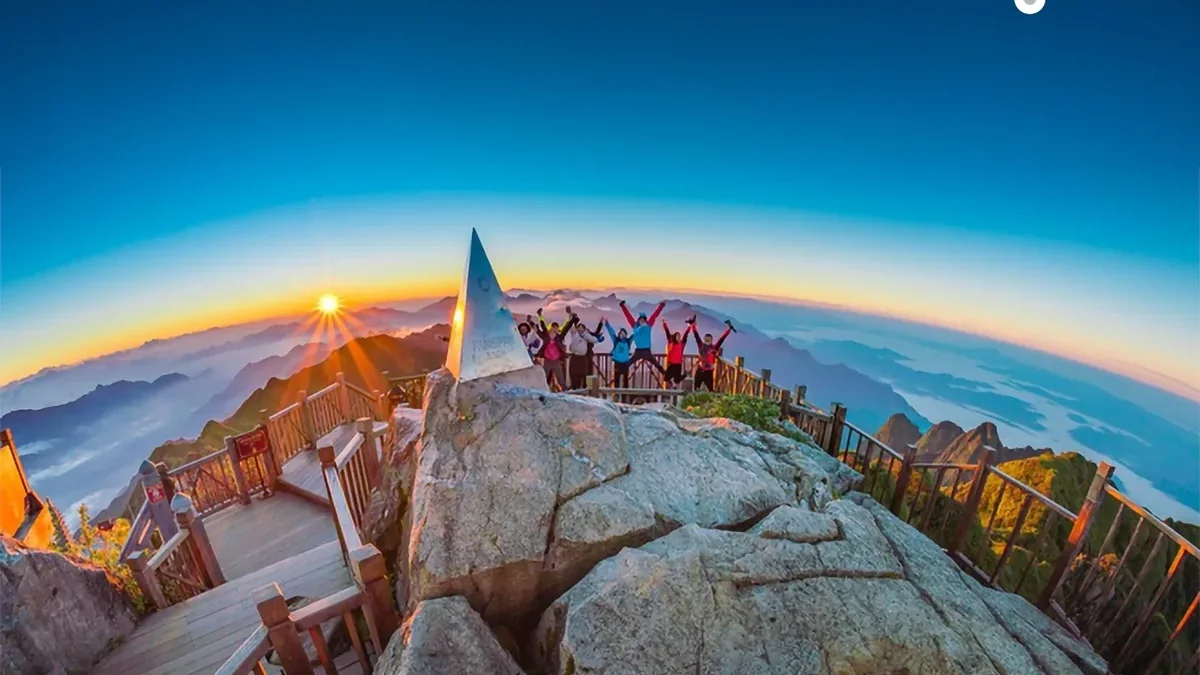
The roof of Indochina — a developed, beginner-friendly trail.
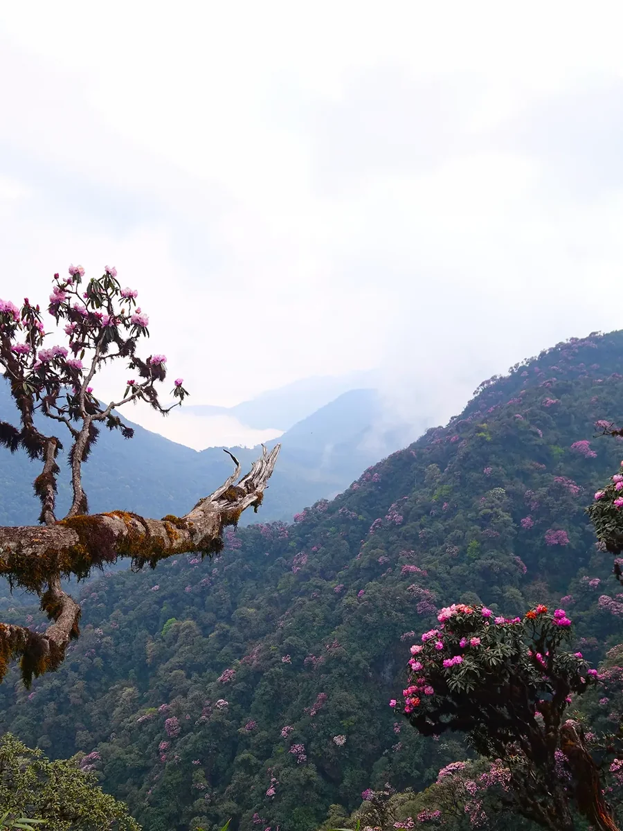
Putaleng (3,049m)
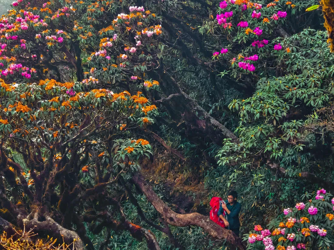
Third highest, through the densest rhododendron forest.
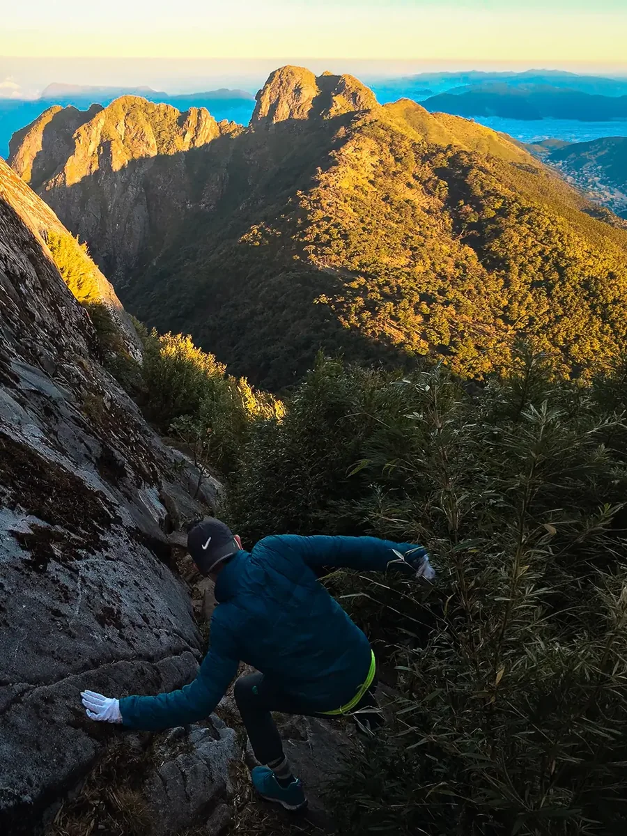
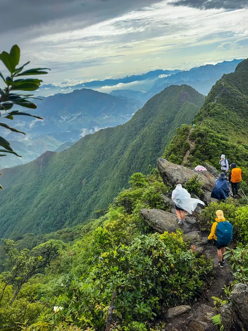
Ky Quan San (3,046m)
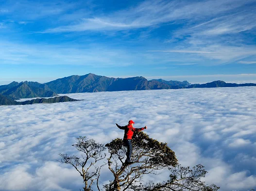
Bạch Mộc Lương Tử — the dinosaur-spine ridge.
3. Where the peaks are — and how to get there
The mountains group by region, and that decides how you travel. The Hoàng Liên Sơn range forms a natural border, with Lào Cai on one side and Lai Châu on the other — many peaks can be climbed from either side.
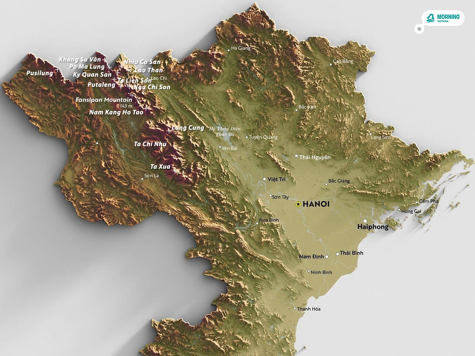
| Region | Some peaks | Getting there |
|---|---|---|
| Sơn La – Yên Bái | Tà Xùa, Tà Chì Nhù, Lùng Cúng, Sa Mu | 16–29-seat van, or sleeper bus along Highway 32 (Thanh Sơn → Nghĩa Lộ → Mù Cang Chải → Lai Châu) |
| Lào Cai side | Fansipan, Ngũ Chỉ Sơn, Lảo Thẩn, Nhìu Cồ San, Ky Quan San | Sleeper bus Hanoi ↔ Sa Pa, then provincial roads off Highway 4D by van or car |
| Lai Châu side | Putaleng, Tả Liên Sơn, Nam Kang Ho Tao, Chu Va | Sleeper bus to Tam Đường or Lai Châu city, then a van to the trailhead |
| Inside Lai Châu | Pờ Ma Lung, Chung Nhía Vũ, Pusilung, Khang Su Văn | Sleeper bus to Lai Châu city, then a hired car; Pusilung has a direct bus to Mường Tè |
A practical note on transport: the best bus service runs the Sa Pa route. Lai Châu buses are a step below but fine — book your seat ahead and confirm the details with the operator. Yên Bái buses are similar, but Highway 32 is rougher and more tiring than the Nội Bài – Lào Cai expressway.
4. Three ways to organize a trek — and what each costs
Organizing a climb for anywhere from one to twenty people is simpler than it looks. The costs are always the same ingredients: transport from Hanoi to the trailhead, accommodation (mountain shelters, guesthouses), food, porter fees, and extras like medals, border-area permits and photos. There are three common ways to put it together.
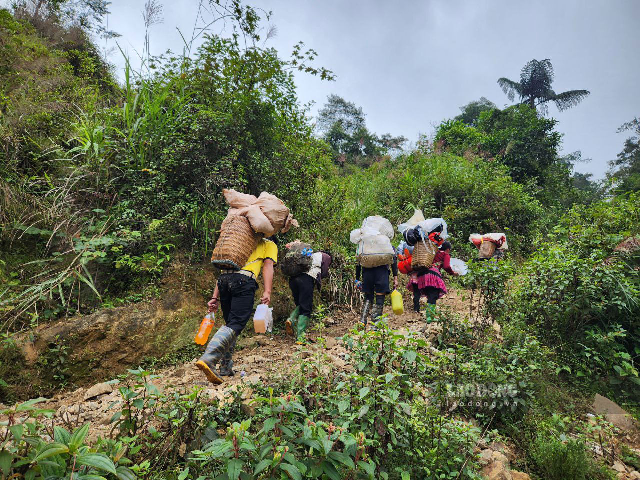
Do it yourself. Your group arranges everything from A to Z. Porters run about 500,000–700,000₫ per day. This is the simplest and cheapest on paper, but also the most work and the most unknowns — the lowest realistic cost is around 1.5 million₫ per person, depending on what you need.
All-inclusive porter package. Many experienced porters now run the whole trip themselves at a flat price. You only book your own bus to Sa Pa, Lai Châu or Yên Bái, and the porter meets your group and takes care of the rest. This costs more than DIY but less than a full tour, and the money goes straight to the local porters and their villages. It does need one person in the group to coordinate transport, the porter contact and the plan.
Full guided tour. Everything is arranged end to end — you pay and you set off. For reference, Morning Vietnam’s trekking-only trips (starting from Sa Pa) run from $103 for Putaleng (2D1N), $109 for Ky Quan San (3D2N) and $117 for Fansipan (2D1N); the full versions from Hanoi, with the bus and extra days included, run roughly $155–180.
| Model | What you handle | Rough cost (2–3 day peak) |
|---|---|---|
| DIY | Everything, A to Z | From ~1.5M₫; porters 500–700k₫/day |
| Porter package | Just your bus to the region | ~2.5–3M₫ per person |
| Full tour | Nothing — booked end to end | MVN trekking-only from $103–117 (from Sa Pa) |
Whichever model you pick, the sweet spot for group size is 5–6 or 10–12 people — enough to share the load and fill a dinner table, small enough to stay flexible. Even on a tour, keeping the group to 6–12 keeps the service quality up.
5. When to go
The best windows are roughly September to November and March to May, when the weather is mild and skies are clearer. March–April brings the rhododendron bloom on peaks like Putaleng, and the November–March months are the classic cloud-hunting season on ridges like Tà Xùa. Avoid the heavy rains from about May to August: trails turn extremely slippery and the landslide risk climbs. As with everything in the mountains, check conditions close to your dates — a clear forecast matters more than the month on the calendar.
6. Trek these peaks with Morning Vietnam
Before Morning Vietnam, these were the mountains we climbed on our own weekends — DIY, with porters we trusted, learning each route the hard way. Now we run them as guided treks, with the same local porters and a format built for small groups: real wilderness camps, dawn summits, and a Red Dao herbal bath to finish.
Explore all our peak treks, or go straight to Fansipan (3,143m, the roof of Indochina), Putaleng (3,049m, through the densest rhododendron forest in the northwest), or Ky Quan San / Bạch Mộc Lương Tử (3,046m, the dinosaur-spine ridge). Prefer something gentler first? The Hoàng Liên Old-Growth Forest Trek is a single day among ancient trees, half an hour from Sa Pa.
7. FAQ
Which Vietnamese peak is best for a first trek?
Most beginners start with Lảo Thẩn or Tà Xùa — high enough to feel like a real mountain (around 2,860m) but graded easy, usually two days with a guide. From there people work up to Fansipan, Putaleng and Ky Quan San. If you want altitude without much technical difficulty, Fansipan’s Trạm Tôn route is also beginner-friendly despite being the highest peak, because the trail is well developed.
Do I need a guide and a permit?
For the high peaks, yes. Trails lead deep into forest and national park land, and a licensed local guide is standard. For Fansipan specifically, national park permits, forest-ranger clearance and a licensed guide have been mandatory since 2026. A reputable operator arranges all of this for you.
How fit do I need to be?
You don’t need to be an athlete, but these are real multi-day climbs with long days (7–10 hours) and steep, often muddy terrain. If you can walk uphill for several hours with a daypack, you can do the easier peaks. Harder peaks like Pusilung or Nam Kang Ho Tao demand genuine fitness and multi-day stamina.
When is the best season to trek?
Roughly September to November and March to May, when the weather is mild and skies are clearer. March–April adds the rhododendron bloom on peaks like Putaleng. Avoid the heavy rains from about May to August, when trails get extremely slippery and landslides are a real risk.
How much does a trek cost?
It depends how you organize it. Doing it yourself is cheapest — porters run about 500,000–700,000₫ per day. An all-inclusive porter package runs roughly 2.5–3 million₫ per person for a 2–3 day peak. A full guided tour costs more but you arrange nothing: Morning Vietnam’s trekking-only trips from Sa Pa start from $103 (Putaleng), $109 (Ky Quan San) and $117 (Fansipan).
Is Ky Quan San the same as Bạch Mộc Lương Tử?
Yes — it’s one mountain with two names. Ky Quan San (also written Bạch Mộc Lương Tử), 3,046m on the Lào Cai–Lai Châu border, is Vietnam’s fourth-highest peak. Don’t let the two names fool you into thinking they’re separate summits.